You are here: Home > Network List > TA - USArray Transportable Network (new EarthScope stations) Stations List
> Station R33M Jennings River, BC, CAN > Earthquake Result Viewer
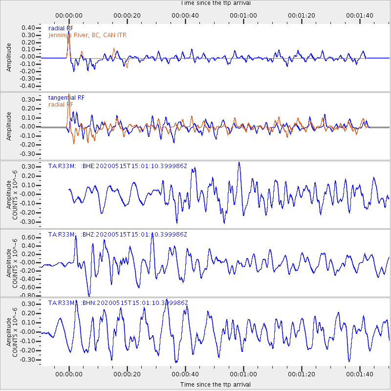
R33M Jennings River, BC, CAN - Earthquake Result Viewer
*The percent match for this event was below the threshold and hence no stack was calculated.
| Earthquake location: |
Samoa Islands Region |
| Earthquake latitude/longitude: |
-15.6/-173.0 |
| Earthquake time(UTC): |
2020/05/15 (136) 14:49:21 GMT |
| Earthquake Depth: |
16 km |
| Earthquake Magnitude: |
5.8 mww |
| Earthquake Catalog/Contributor: |
NEIC PDE/us |
|
| Network: |
TA USArray Transportable Network (new EarthScope stations) |
| Station: |
R33M Jennings River, BC, CAN |
| Lat/Lon: |
59.39 N/130.97 W |
| Elevation: |
1437 m |
|
| Distance: |
82.2 deg |
| Az: |
20.221 deg |
| Baz: |
220.611 deg |
| Ray Param: |
$rayparam |
*The percent match for this event was below the threshold and hence was not used in the summary stack. |
|
| Radial Match: |
63.440205 % |
| Radial Bump: |
368 |
| Transverse Match: |
65.39721 % |
| Transverse Bump: |
400 |
| SOD ConfigId: |
21166931 |
| Insert Time: |
2020-05-29 15:08:26.917 +0000 |
| GWidth: |
2.5 |
| Max Bumps: |
400 |
| Tol: |
0.001 |
|
Signal To Noise
| Channel | StoN | STA | LTA |
| TA:R33M: :BHZ:20200515T15:01:10.399986Z | 2.414723 | 2.1578991E-7 | 8.9364256E-8 |
| TA:R33M: :BHN:20200515T15:01:10.399986Z | 4.741869 | 1.7569326E-7 | 3.705148E-8 |
| TA:R33M: :BHE:20200515T15:01:10.399986Z | 0.9142766 | 7.3211E-8 | 8.0075324E-8 |
| Arrivals |
| Ps | |
| PpPs | |
| PsPs/PpSs | |


