You are here: Home > Network List > US - United States National Seismic Network Stations List
> Station EGMT Eagleton, Montana, USA > Earthquake Result Viewer
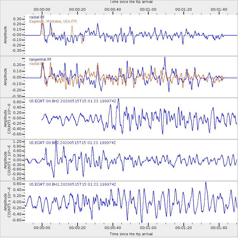
EGMT Eagleton, Montana, USA - Earthquake Result Viewer
*The percent match for this event was below the threshold and hence no stack was calculated.
| Earthquake location: |
Samoa Islands Region |
| Earthquake latitude/longitude: |
-15.6/-173.0 |
| Earthquake time(UTC): |
2020/05/15 (136) 14:49:21 GMT |
| Earthquake Depth: |
16 km |
| Earthquake Magnitude: |
5.8 mww |
| Earthquake Catalog/Contributor: |
NEIC PDE/us |
|
| Network: |
US United States National Seismic Network |
| Station: |
EGMT Eagleton, Montana, USA |
| Lat/Lon: |
48.02 N/109.75 W |
| Elevation: |
1055 m |
|
| Distance: |
84.7 deg |
| Az: |
37.007 deg |
| Baz: |
239.765 deg |
| Ray Param: |
$rayparam |
*The percent match for this event was below the threshold and hence was not used in the summary stack. |
|
| Radial Match: |
63.939037 % |
| Radial Bump: |
400 |
| Transverse Match: |
64.56169 % |
| Transverse Bump: |
400 |
| SOD ConfigId: |
21166931 |
| Insert Time: |
2020-05-29 15:10:24.983 +0000 |
| GWidth: |
2.5 |
| Max Bumps: |
400 |
| Tol: |
0.001 |
|
Signal To Noise
| Channel | StoN | STA | LTA |
| US:EGMT:00:BHZ:20200515T15:01:23.199974Z | 3.117822 | 2.878446E-7 | 9.2322345E-8 |
| US:EGMT:00:BH1:20200515T15:01:23.199974Z | 1.7776431 | 2.1019581E-7 | 1.182441E-7 |
| US:EGMT:00:BH2:20200515T15:01:23.199974Z | 1.1245934 | 1.2796747E-7 | 1.1378999E-7 |
| Arrivals |
| Ps | |
| PpPs | |
| PsPs/PpSs | |


