You are here: Home > Network List > US - United States National Seismic Network Stations List
> Station LAO LASA Array, Montana, USA > Earthquake Result Viewer
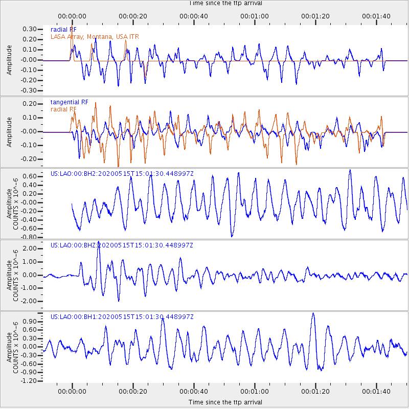
LAO LASA Array, Montana, USA - Earthquake Result Viewer
*The percent match for this event was below the threshold and hence no stack was calculated.
| Earthquake location: |
Samoa Islands Region |
| Earthquake latitude/longitude: |
-15.6/-173.0 |
| Earthquake time(UTC): |
2020/05/15 (136) 14:49:21 GMT |
| Earthquake Depth: |
16 km |
| Earthquake Magnitude: |
5.8 mww |
| Earthquake Catalog/Contributor: |
NEIC PDE/us |
|
| Network: |
US United States National Seismic Network |
| Station: |
LAO LASA Array, Montana, USA |
| Lat/Lon: |
46.69 N/106.22 W |
| Elevation: |
902 m |
|
| Distance: |
86.1 deg |
| Az: |
39.343 deg |
| Baz: |
242.544 deg |
| Ray Param: |
$rayparam |
*The percent match for this event was below the threshold and hence was not used in the summary stack. |
|
| Radial Match: |
82.22233 % |
| Radial Bump: |
400 |
| Transverse Match: |
48.72638 % |
| Transverse Bump: |
400 |
| SOD ConfigId: |
21166931 |
| Insert Time: |
2020-05-29 15:10:35.194 +0000 |
| GWidth: |
2.5 |
| Max Bumps: |
400 |
| Tol: |
0.001 |
|
Signal To Noise
| Channel | StoN | STA | LTA |
| US:LAO:00:BHZ:20200515T15:01:30.448997Z | 2.459925 | 4.3108673E-7 | 1.7524387E-7 |
| US:LAO:00:BH1:20200515T15:01:30.448997Z | 0.6783708 | 1.7389453E-7 | 2.5634145E-7 |
| US:LAO:00:BH2:20200515T15:01:30.448997Z | 1.3432608 | 3.5041188E-7 | 2.608666E-7 |
| Arrivals |
| Ps | |
| PpPs | |
| PsPs/PpSs | |


