KBK KN.KBK - Earthquake Result Viewer
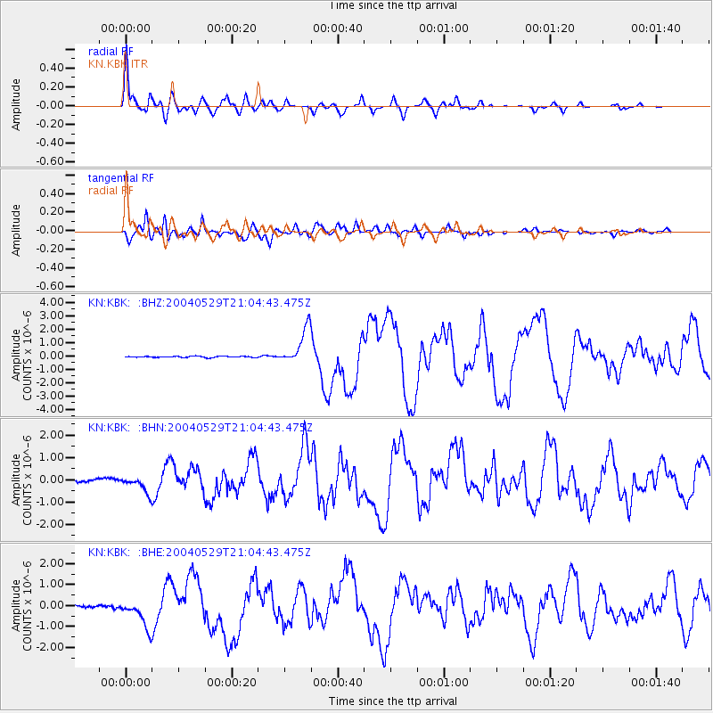
Earthquake location: Off East Coast Of Honshu, Japan
Earthquake latitude/longitude: 34.3/141.4
Earthquake time(UTC): 2004/05/29 (150) 20:56:09 GMT
Earthquake Depth: 16 km
Earthquake Magnitude: 5.6 MB, 6.6 MS, 6.5 MW, 6.3 MW
Earthquake Catalog/Contributor: WHDF/NEIC
Network: KN Kyrgyz Seismic Telemetry Network
Station: KBK KN.KBK
Lat/Lon: 42.66 N/74.95 E
Elevation: 1760 m
Distance: 51.5 deg
Az: 300.235 deg
Baz: 75.959 deg
Ray Param: 0.06734975
Estimated Moho Depth: 63.25 km
Estimated Crust Vp/Vs: 1.83
Assumed Crust Vp: 6.306 km/s
Estimated Crust Vs: 3.455 km/s
Estimated Crust Poisson's Ratio: 0.29
Radial Match: 95.26794 %
Radial Bump: 400
Transverse Match: 92.53527 %
Transverse Bump: 400
SOD ConfigId: 2459
Insert Time: 2010-03-08 20:09:19.000 +0000
GWidth: 2.5
Max Bumps: 400
Tol: 0.001

Signal To Noise

ChannelStoNSTALTA
KN:KBK: :BHN:20040529T21:04:43.475Z6.20696073.5894746E-75.7829826E-8
KN:KBK: :BHE:20040529T21:04:43.475Z6.30937777.206509E-71.1421902E-7
KN:KBK: :BHZ:20040529T21:04:43.475Z29.9337541.373321E-64.5878675E-8
Arrivals
Ps8.7 SECOND
PpPs27 SECOND
PsPs/PpSs36 SECOND