
KBK KN.KBK - Earthquake Result Viewer
| ||||||||||||||||||
| ||||||||||||||||||
| ||||||||||||||||||
|
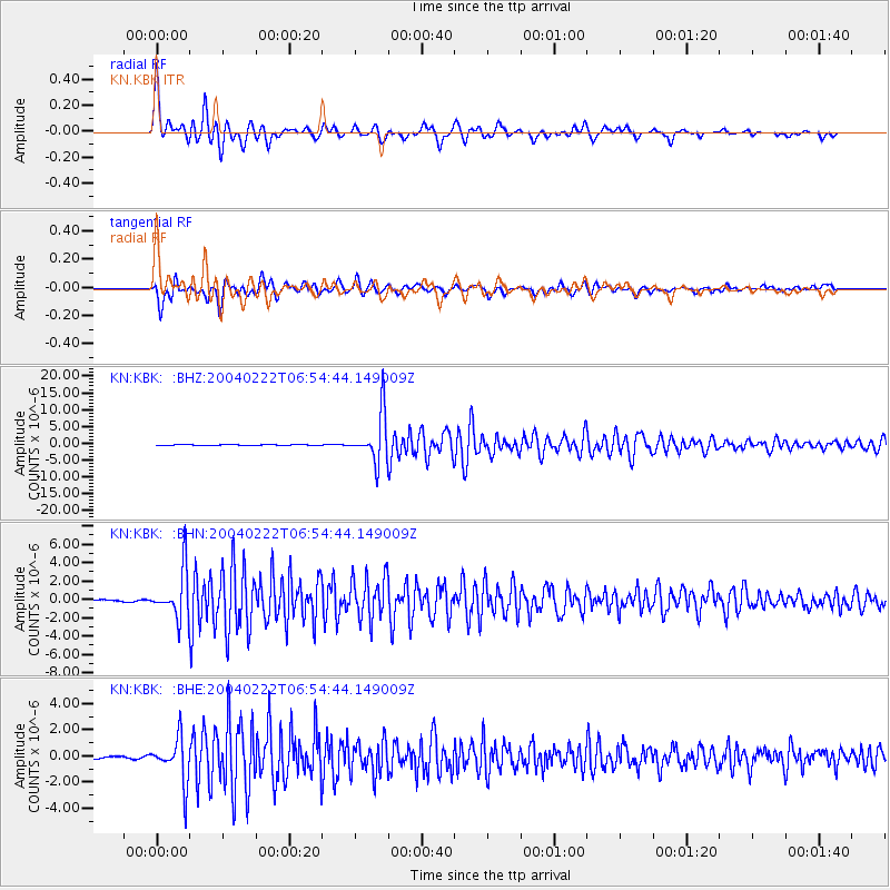
Signal To Noise
| Channel | StoN | STA | LTA |
| KN:KBK: :BHN:20040222T06:54:44.149009Z | 24.09909 | 2.5665986E-6 | 1.06501886E-7 |
| KN:KBK: :BHE:20040222T06:54:44.149009Z | 18.012959 | 1.7022282E-6 | 9.45002E-8 |
| KN:KBK: :BHZ:20040222T06:54:44.149009Z | 64.2111 | 7.1527975E-6 | 1.1139504E-7 |
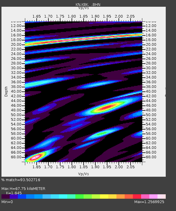
| Arrivals | |
| Ps | 7.4 SECOND |
| PpPs | 27 SECOND |
| PsPs/PpSs | 34 SECOND |

