You are here: Home > Network List > TA - USArray Transportable Network (new EarthScope stations) Stations List
> Station I17K Unalakleet, AK, USA > Earthquake Result Viewer
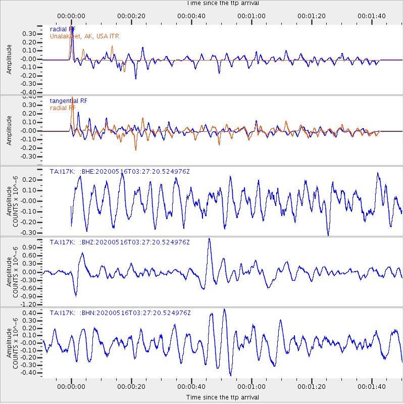
I17K Unalakleet, AK, USA - Earthquake Result Viewer
*The percent match for this event was below the threshold and hence no stack was calculated.
| Earthquake location: |
Vanuatu Islands |
| Earthquake latitude/longitude: |
-16.1/168.0 |
| Earthquake time(UTC): |
2020/05/16 (137) 03:15:43 GMT |
| Earthquake Depth: |
166 km |
| Earthquake Magnitude: |
5.9 mww |
| Earthquake Catalog/Contributor: |
NEIC PDE/us |
|
| Network: |
TA USArray Transportable Network (new EarthScope stations) |
| Station: |
I17K Unalakleet, AK, USA |
| Lat/Lon: |
63.89 N/160.70 W |
| Elevation: |
105 m |
|
| Distance: |
83.3 deg |
| Az: |
13.394 deg |
| Baz: |
210.211 deg |
| Ray Param: |
$rayparam |
*The percent match for this event was below the threshold and hence was not used in the summary stack. |
|
| Radial Match: |
59.649433 % |
| Radial Bump: |
345 |
| Transverse Match: |
62.88905 % |
| Transverse Bump: |
393 |
| SOD ConfigId: |
21166931 |
| Insert Time: |
2020-05-30 03:27:29.534 +0000 |
| GWidth: |
2.5 |
| Max Bumps: |
400 |
| Tol: |
0.001 |
|
Signal To Noise
| Channel | StoN | STA | LTA |
| TA:I17K: :BHZ:20200516T03:27:20.524976Z | 6.776927 | 4.665092E-7 | 6.883786E-8 |
| TA:I17K: :BHN:20200516T03:27:20.524976Z | 1.4667712 | 1.3384489E-7 | 9.1251366E-8 |
| TA:I17K: :BHE:20200516T03:27:20.524976Z | 0.882195 | 1.1988801E-7 | 1.3589741E-7 |
| Arrivals |
| Ps | |
| PpPs | |
| PsPs/PpSs | |


