You are here: Home > Network List > GS - US Geological Survey Networks Stations List
> Station OK031 S. Brethren Rd., Cushing, OK, USA > Earthquake Result Viewer
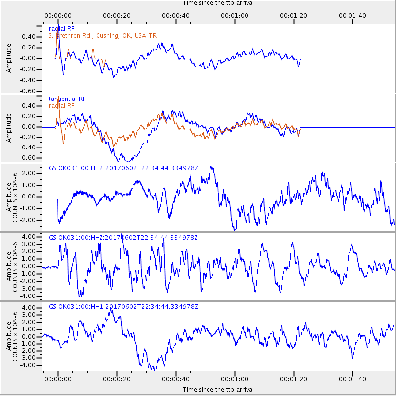
OK031 S. Brethren Rd., Cushing, OK, USA - Earthquake Result Viewer
*The percent match for this event was below the threshold and hence no stack was calculated.
| Earthquake location: |
Near Islands, Aleutian Islands |
| Earthquake latitude/longitude: |
54.0/170.9 |
| Earthquake time(UTC): |
2017/06/02 (153) 22:24:47 GMT |
| Earthquake Depth: |
8.2 km |
| Earthquake Magnitude: |
6.8 Mww |
| Earthquake Catalog/Contributor: |
NEIC PDE/us |
|
| Network: |
GS US Geological Survey Networks |
| Station: |
OK031 S. Brethren Rd., Cushing, OK, USA |
| Lat/Lon: |
35.95 N/96.84 W |
| Elevation: |
290 m |
|
| Distance: |
63.1 deg |
| Az: |
65.435 deg |
| Baz: |
318.6 deg |
| Ray Param: |
$rayparam |
*The percent match for this event was below the threshold and hence was not used in the summary stack. |
|
| Radial Match: |
71.186005 % |
| Radial Bump: |
400 |
| Transverse Match: |
51.588078 % |
| Transverse Bump: |
400 |
| SOD ConfigId: |
2140511 |
| Insert Time: |
2017-06-16 14:21:39.719 +0000 |
| GWidth: |
2.5 |
| Max Bumps: |
400 |
| Tol: |
0.001 |
|
Signal To Noise
| Channel | StoN | STA | LTA |
| GS:OK031:00:HHZ:20170602T22:34:44.334978Z | 20.66077 | 1.6821019E-6 | 8.141525E-8 |
| GS:OK031:00:HH1:20170602T22:34:44.334978Z | 0.5589861 | 9.1253145E-7 | 1.632476E-6 |
| GS:OK031:00:HH2:20170602T22:34:44.334978Z | 0.84590775 | 5.601573E-7 | 6.621966E-7 |
| Arrivals |
| Ps | |
| PpPs | |
| PsPs/PpSs | |


