KBK KN.KBK - Earthquake Result Viewer
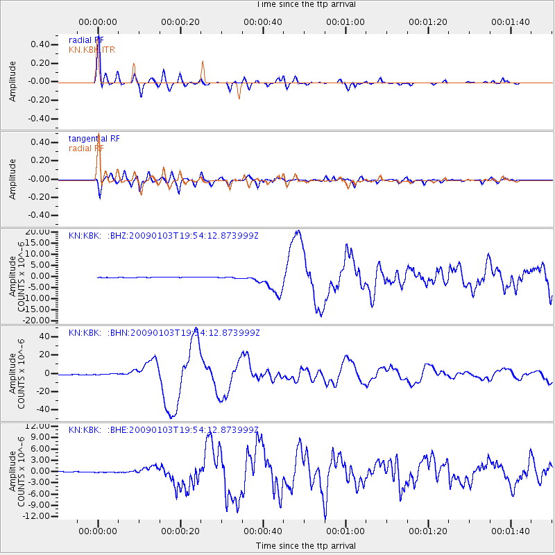
Earthquake location: Irian Jaya Region, Indonesia
Earthquake latitude/longitude: -0.4/132.9
Earthquake time(UTC): 2009/01/03 (003) 19:43:50 GMT
Earthquake Depth: 17 km
Earthquake Magnitude: 6.6 MB, 7.5 MS, 7.6 MW, 7.6 MW
Earthquake Catalog/Contributor: WHDF/NEIC
Network: KN Kyrgyz Seismic Telemetry Network
Station: KBK KN.KBK
Lat/Lon: 42.66 N/74.95 E
Elevation: 1760 m
Distance: 67.2 deg
Az: 317.318 deg
Baz: 113.227 deg
Ray Param: 0.057066012
Estimated Moho Depth: 27.5 km
Estimated Crust Vp/Vs: 2.05
Assumed Crust Vp: 6.306 km/s
Estimated Crust Vs: 3.08 km/s
Estimated Crust Poisson's Ratio: 0.34
Radial Match: 96.29317 %
Radial Bump: 400
Transverse Match: 91.890526 %
Transverse Bump: 400
SOD ConfigId: 2834
Insert Time: 2010-03-08 20:11:51.196 +0000
GWidth: 2.5
Max Bumps: 400
Tol: 0.001

Signal To Noise

ChannelStoNSTALTA
KN:KBK: :BHN:20090103T19:54:12.873999Z6.4614675.91937E-79.161032E-8
KN:KBK: :BHE:20090103T19:54:12.873999Z0.646854648.891307E-81.3745448E-7
KN:KBK: :BHZ:20090103T19:54:12.873999Z3.01220443.032721E-71.00681106E-7
Arrivals
Ps4.7 SECOND
PpPs13 SECOND
PsPs/PpSs18 SECOND