You are here: Home > Network List > KN - Kyrgyz Seismic Telemetry Network Stations List
> Station KBK KN.KBK > Earthquake Result Viewer
KBK KN.KBK - Earthquake Result Viewer

| Earthquake location: |
Svalbard Region |
| Earthquake latitude/longitude: |
78.5/5.1 |
| Earthquake time(UTC): |
1992/07/20 (202) 07:46:46 GMT |
| Earthquake Depth: |
10 km |
| Earthquake Magnitude: |
5.8 MB, 6.3 MS |
| Earthquake Catalog/Contributor: |
WHDF/NEIC |
|
| Network: |
KN Kyrgyz Seismic Telemetry Network |
| Station: |
KBK KN.KBK |
| Lat/Lon: |
42.66 N/74.95 E |
| Elevation: |
1760 m |
|
| Distance: |
44.6 deg |
| Az: |
99.229 deg |
| Baz: |
344.382 deg |
| Ray Param: |
0.07183324 |
| Estimated Moho Depth: |
26.75 km |
| Estimated Crust Vp/Vs: |
1.88 |
| Assumed Crust Vp: |
6.306 km/s |
| Estimated Crust Vs: |
3.35 km/s |
| Estimated Crust Poisson's Ratio: |
0.30 |
|
| Radial Match: |
96.75181 % |
| Radial Bump: |
344 |
| Transverse Match: |
92.51444 % |
| Transverse Bump: |
400 |
| SOD ConfigId: |
4480 |
| Insert Time: |
2010-03-08 20:11:59.125 +0000 |
| GWidth: |
2.5 |
| Max Bumps: |
400 |
| Tol: |
0.001 |
|
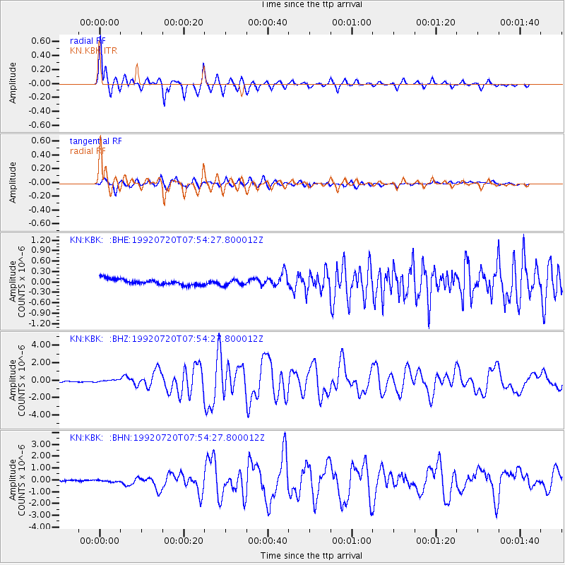
Signal To Noise
| Channel | StoN | STA | LTA |
| KN:KBK: :BHZ:19920720T07:54:27.800012Z | 2.1844723 | 1.3306733E-7 | 6.091509E-8 |
| KN:KBK: :BHN:19920720T07:54:27.800012Z | 1.4234197 | 6.6472026E-8 | 4.6698826E-8 |
| KN:KBK: :BHE:19920720T07:54:27.800012Z | 1.02299 | 8.456543E-8 | 8.2664954E-8 |
| Arrivals |
| Ps | 4.0 SECOND |
| PpPs | 12 SECOND |
| PsPs/PpSs | 16 SECOND |


