KBK KN.KBK - Earthquake Result Viewer
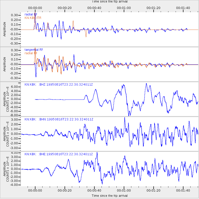
Earthquake location: Solomon Islands
Earthquake latitude/longitude: -5.8/154.3
Earthquake time(UTC): 1995/08/16 (228) 23:10:28 GMT
Earthquake Depth: 74 km
Earthquake Magnitude: 6.1 MB, 7.2 MS, 7.2 UNKNOWN, 7.2 MW
Earthquake Catalog/Contributor: WHDF/NEIC
Network: KN Kyrgyz Seismic Telemetry Network
Station: KBK KN.KBK
Lat/Lon: 42.66 N/74.95 E
Elevation: 1760 m
Distance: 86.1 deg
Az: 313.398 deg
Baz: 101.474 deg
Ray Param: 0.044173762
Estimated Moho Depth: 14.0 km
Estimated Crust Vp/Vs: 1.69
Assumed Crust Vp: 6.306 km/s
Estimated Crust Vs: 3.742 km/s
Estimated Crust Poisson's Ratio: 0.23
Radial Match: 92.82124 %
Radial Bump: 400
Transverse Match: 86.883896 %
Transverse Bump: 400
SOD ConfigId: 6273
Insert Time: 2010-03-08 20:13:07.394 +0000
GWidth: 2.5
Max Bumps: 400
Tol: 0.001

Signal To Noise

ChannelStoNSTALTA
KN:KBK: :BHN:19950816T23:22:30.324011Z1.01780949.072697E-88.913945E-8
KN:KBK: :BHE:19950816T23:22:30.324011Z2.95569632.3637745E-77.9973525E-8
KN:KBK: :BHZ:19950816T23:22:30.324011Z12.6149818.975516E-77.114966E-8
Arrivals
Ps1.6 SECOND
PpPs5.8 SECOND
PsPs/PpSs7.4 SECOND