
KBK KN.KBK - Earthquake Result Viewer
| ||||||||||||||||||
| ||||||||||||||||||
| ||||||||||||||||||
|
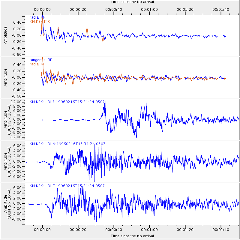
Signal To Noise
| Channel | StoN | STA | LTA |
| KN:KBK: :BHN:19960216T15:31:24.050Z | 3.2238693 | 7.484543E-7 | 2.3216023E-7 |
| KN:KBK: :BHE:19960216T15:31:24.050Z | 13.994961 | 1.2739747E-6 | 9.1030955E-8 |
| KN:KBK: :BHZ:19960216T15:31:24.050Z | 14.680431 | 2.980274E-6 | 2.0300998E-7 |
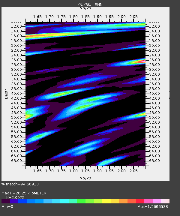
| Arrivals | |
| Ps | 4.8 SECOND |
| PpPs | 12 SECOND |
| PsPs/PpSs | 17 SECOND |

