
KBK KN.KBK - Earthquake Result Viewer
| ||||||||||||||||||
| ||||||||||||||||||
| ||||||||||||||||||
|
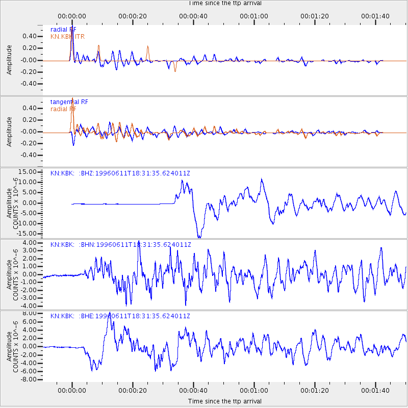
Signal To Noise
| Channel | StoN | STA | LTA |
| KN:KBK: :BHN:19960611T18:31:35.624011Z | 3.351836 | 2.2874767E-7 | 6.824548E-8 |
| KN:KBK: :BHE:19960611T18:31:35.624011Z | 9.626998 | 5.5024555E-7 | 5.715651E-8 |
| KN:KBK: :BHZ:19960611T18:31:35.624011Z | 24.646505 | 1.4223824E-6 | 5.7711322E-8 |
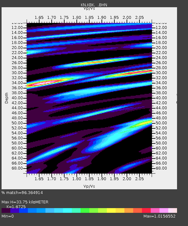
| Arrivals | |
| Ps | 3.8 SECOND |
| PpPs | 14 SECOND |
| PsPs/PpSs | 17 SECOND |

