KBK KN.KBK - Earthquake Result Viewer
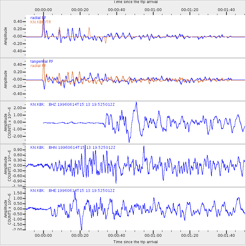
Earthquake location: Samar, Philippines
Earthquake latitude/longitude: 12.8/125.1
Earthquake time(UTC): 1996/06/14 (166) 15:04:40 GMT
Earthquake Depth: 29 km
Earthquake Magnitude: 5.6 MB, 5.8 MS, 6.1 UNKNOWN, 5.9 MW
Earthquake Catalog/Contributor: WHDF/NEIC
Network: KN Kyrgyz Seismic Telemetry Network
Station: KBK KN.KBK
Lat/Lon: 42.66 N/74.95 E
Elevation: 1760 m
Distance: 52.4 deg
Az: 314.402 deg
Baz: 109.146 deg
Ray Param: 0.06673894
Estimated Moho Depth: 29.5 km
Estimated Crust Vp/Vs: 2.04
Assumed Crust Vp: 6.306 km/s
Estimated Crust Vs: 3.087 km/s
Estimated Crust Poisson's Ratio: 0.34
Radial Match: 92.43459 %
Radial Bump: 400
Transverse Match: 81.473434 %
Transverse Bump: 400
SOD ConfigId: 6273
Insert Time: 2010-03-08 20:14:37.761 +0000
GWidth: 2.5
Max Bumps: 400
Tol: 0.001

Signal To Noise

ChannelStoNSTALTA
KN:KBK: :BHN:19960614T15:13:19.525012Z1.73510936.8273145E-83.9348038E-8
KN:KBK: :BHE:19960614T15:13:19.525012Z2.54027581.6798832E-76.612995E-8
KN:KBK: :BHZ:19960614T15:13:19.525012Z8.5104594.1157355E-74.8360913E-8
Arrivals
Ps5.1 SECOND
PpPs14 SECOND
PsPs/PpSs19 SECOND