KBK KN.KBK - Earthquake Result Viewer
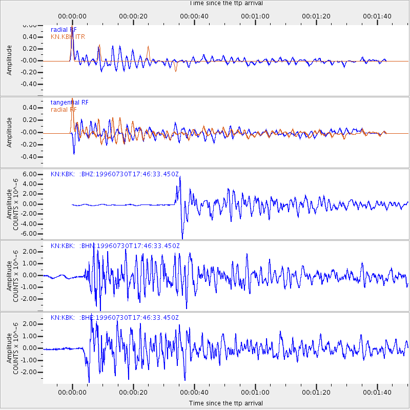
Earthquake location: Luzon, Philippines
Earthquake latitude/longitude: 14.5/120.0
Earthquake time(UTC): 1996/07/30 (212) 17:38:30 GMT
Earthquake Depth: 33 km
Earthquake Magnitude: 6.1 MB, 5.7 MS, 6.1 UNKNOWN, 5.9 MW
Earthquake Catalog/Contributor: WHDF/NEIC
Network: KN Kyrgyz Seismic Telemetry Network
Station: KBK KN.KBK
Lat/Lon: 42.66 N/74.95 E
Elevation: 1760 m
Distance: 47.7 deg
Az: 315.128 deg
Baz: 112.139 deg
Ray Param: 0.069771014
Estimated Moho Depth: 34.75 km
Estimated Crust Vp/Vs: 1.61
Assumed Crust Vp: 6.306 km/s
Estimated Crust Vs: 3.917 km/s
Estimated Crust Poisson's Ratio: 0.19
Radial Match: 92.45797 %
Radial Bump: 400
Transverse Match: 91.982124 %
Transverse Bump: 400
SOD ConfigId: 6273
Insert Time: 2010-03-08 20:14:47.826 +0000
GWidth: 2.5
Max Bumps: 400
Tol: 0.001

Signal To Noise

ChannelStoNSTALTA
KN:KBK: :BHN:19960730T17:46:33.450Z2.8106111.4772743E-75.2560615E-8
KN:KBK: :BHE:19960730T17:46:33.450Z6.26803973.749627E-75.982137E-8
KN:KBK: :BHZ:19960730T17:46:33.450Z11.5654559.621872E-78.319493E-8
Arrivals
Ps3.6 SECOND
PpPs13 SECOND
PsPs/PpSs17 SECOND