You are here: Home > Network List > TA - USArray Transportable Network (new EarthScope stations) Stations List
> Station C16K Lisburne Hills, AK, USA > Earthquake Result Viewer
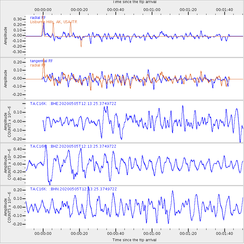
C16K Lisburne Hills, AK, USA - Earthquake Result Viewer
*The percent match for this event was below the threshold and hence no stack was calculated.
| Earthquake location: |
Near Coast Of Guatemala |
| Earthquake latitude/longitude: |
13.3/-91.1 |
| Earthquake time(UTC): |
2020/05/05 (126) 12:02:32 GMT |
| Earthquake Depth: |
8.0 km |
| Earthquake Magnitude: |
5.5 Mww |
| Earthquake Catalog/Contributor: |
NEIC PDE/us |
|
| Network: |
TA USArray Transportable Network (new EarthScope stations) |
| Station: |
C16K Lisburne Hills, AK, USA |
| Lat/Lon: |
68.27 N/165.34 W |
| Elevation: |
102 m |
|
| Distance: |
71.9 deg |
| Az: |
337.858 deg |
| Baz: |
99.731 deg |
| Ray Param: |
$rayparam |
*The percent match for this event was below the threshold and hence was not used in the summary stack. |
|
| Radial Match: |
65.58323 % |
| Radial Bump: |
400 |
| Transverse Match: |
78.42439 % |
| Transverse Bump: |
400 |
| SOD ConfigId: |
21166931 |
| Insert Time: |
2020-06-02 12:26:43.211 +0000 |
| GWidth: |
2.5 |
| Max Bumps: |
400 |
| Tol: |
0.001 |
|
Signal To Noise
| Channel | StoN | STA | LTA |
| TA:C16K: :BHZ:20200505T12:13:25.374972Z | 3.0034359 | 3.4183836E-7 | 1.13815766E-7 |
| TA:C16K: :BHN:20200505T12:13:25.374972Z | 1.1257589 | 4.973436E-8 | 4.417852E-8 |
| TA:C16K: :BHE:20200505T12:13:25.374972Z | 2.4390159 | 9.577408E-8 | 3.926751E-8 |
| Arrivals |
| Ps | |
| PpPs | |
| PsPs/PpSs | |


