KBK KN.KBK - Earthquake Result Viewer
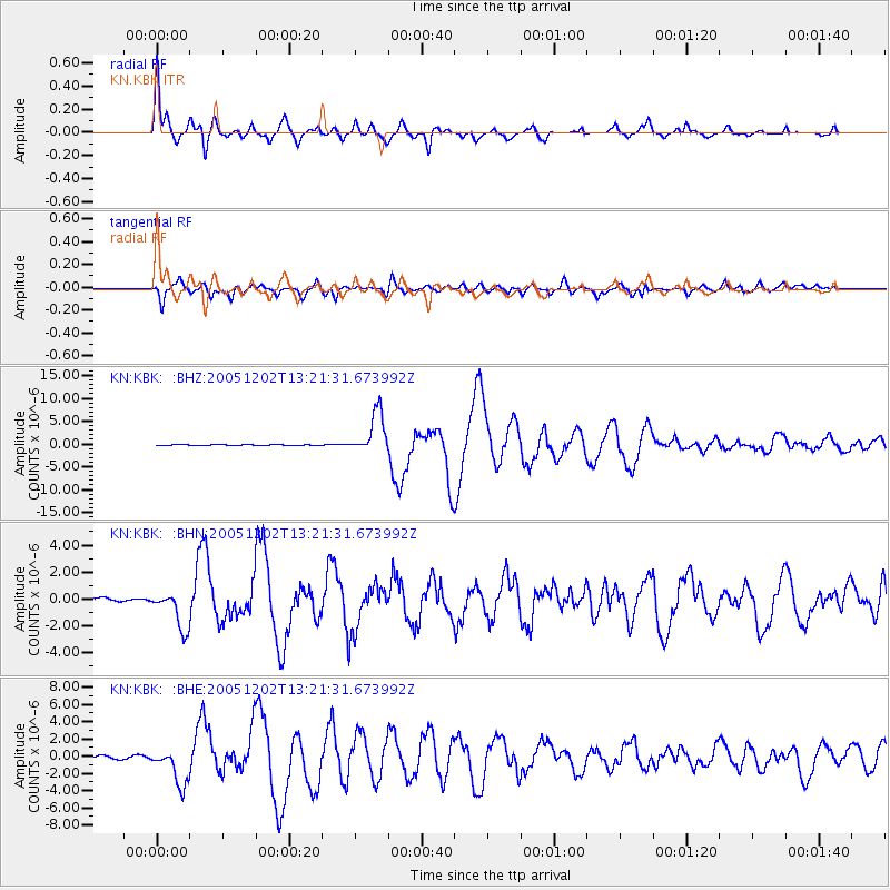
Earthquake location: Near East Coast Of Honshu, Japan
Earthquake latitude/longitude: 38.1/142.1
Earthquake time(UTC): 2005/12/02 (336) 13:13:09 GMT
Earthquake Depth: 29 km
Earthquake Magnitude: 6.1 MB, 6.3 MS, 6.5 MW, 6.4 MW
Earthquake Catalog/Contributor: WHDF/NEIC
Network: KN Kyrgyz Seismic Telemetry Network
Station: KBK KN.KBK
Lat/Lon: 42.66 N/74.95 E
Elevation: 1760 m
Distance: 50.2 deg
Az: 297.697 deg
Baz: 71.275 deg
Ray Param: 0.068185896
Estimated Moho Depth: 15.25 km
Estimated Crust Vp/Vs: 1.62
Assumed Crust Vp: 6.306 km/s
Estimated Crust Vs: 3.905 km/s
Estimated Crust Poisson's Ratio: 0.19
Radial Match: 95.66368 %
Radial Bump: 327
Transverse Match: 92.75201 %
Transverse Bump: 400
SOD ConfigId: 2422
Insert Time: 2010-03-08 20:15:30.742 +0000
GWidth: 2.5
Max Bumps: 400
Tol: 0.001

Signal To Noise

ChannelStoNSTALTA
KN:KBK: :BHN:20051202T13:21:31.673992Z5.1811941.3307316E-62.568388E-7
KN:KBK: :BHE:20051202T13:21:31.673992Z7.14872262.0661876E-62.8902892E-7
KN:KBK: :BHZ:20051202T13:21:31.673992Z65.726154.560527E-66.93868E-8
Arrivals
Ps1.6 SECOND
PpPs5.9 SECOND
PsPs/PpSs7.5 SECOND