You are here: Home > Network List > TA - USArray Transportable Network (new EarthScope stations) Stations List
> Station K15K Wolf Creek Mountain, AK, USA > Earthquake Result Viewer
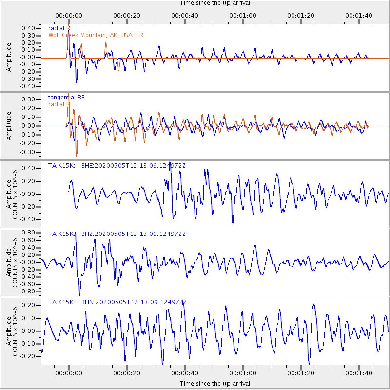
K15K Wolf Creek Mountain, AK, USA - Earthquake Result Viewer
*The percent match for this event was below the threshold and hence no stack was calculated.
| Earthquake location: |
Near Coast Of Guatemala |
| Earthquake latitude/longitude: |
13.3/-91.1 |
| Earthquake time(UTC): |
2020/05/05 (126) 12:02:32 GMT |
| Earthquake Depth: |
8.0 km |
| Earthquake Magnitude: |
5.5 Mww |
| Earthquake Catalog/Contributor: |
NEIC PDE/us |
|
| Network: |
TA USArray Transportable Network (new EarthScope stations) |
| Station: |
K15K Wolf Creek Mountain, AK, USA |
| Lat/Lon: |
62.29 N/161.53 W |
| Elevation: |
346 m |
|
| Distance: |
69.2 deg |
| Az: |
331.908 deg |
| Baz: |
101.215 deg |
| Ray Param: |
$rayparam |
*The percent match for this event was below the threshold and hence was not used in the summary stack. |
|
| Radial Match: |
58.268303 % |
| Radial Bump: |
400 |
| Transverse Match: |
67.088844 % |
| Transverse Bump: |
400 |
| SOD ConfigId: |
21166931 |
| Insert Time: |
2020-06-02 12:28:30.096 +0000 |
| GWidth: |
2.5 |
| Max Bumps: |
400 |
| Tol: |
0.001 |
|
Signal To Noise
| Channel | StoN | STA | LTA |
| TA:K15K: :BHZ:20200505T12:13:09.124972Z | 5.8274093 | 4.0688E-7 | 6.9821766E-8 |
| TA:K15K: :BHN:20200505T12:13:09.124972Z | 0.6308225 | 4.7433993E-8 | 7.519388E-8 |
| TA:K15K: :BHE:20200505T12:13:09.124972Z | 2.173911 | 1.9228854E-7 | 8.84528E-8 |
| Arrivals |
| Ps | |
| PpPs | |
| PsPs/PpSs | |


