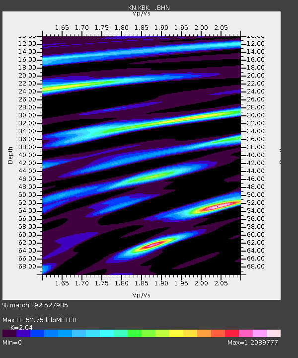
KBK KN.KBK - Earthquake Result Viewer
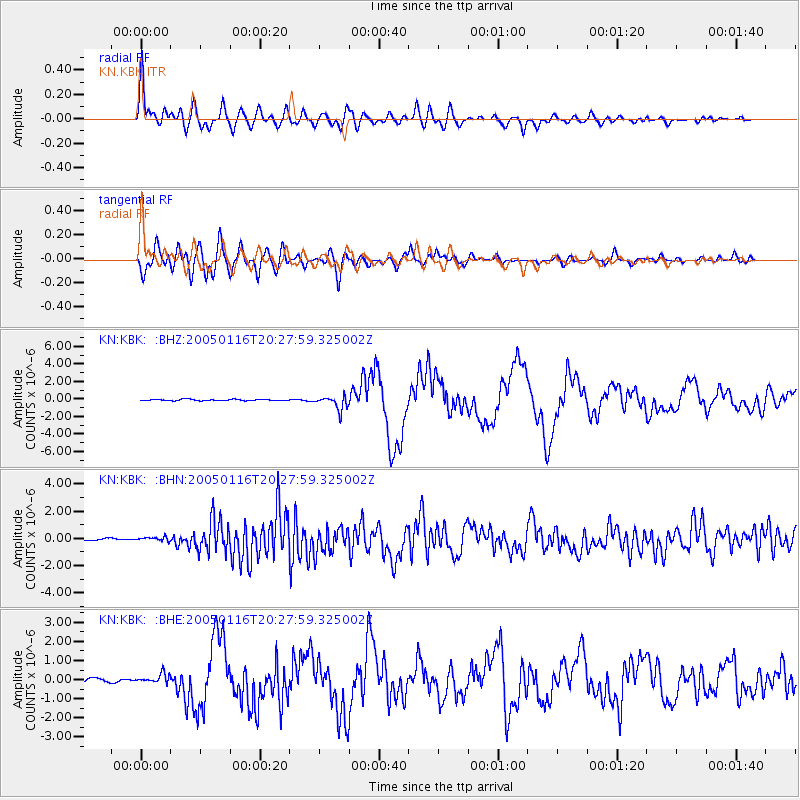
Earthquake location: W. Caroline Islands, Micronesia
Earthquake latitude/longitude: 10.9/140.8
Earthquake time(UTC): 2005/01/16 (016) 20:17:52 GMT
Earthquake Depth: 25 km
Earthquake Magnitude: 6.3 MB, 6.7 MS, 6.6 MW, 6.6 MW
Earthquake Catalog/Contributor: WHDF/NEIC
Network: KN Kyrgyz Seismic Telemetry Network
Station: KBK KN.KBK
Lat/Lon: 42.66 N/74.95 E
Elevation: 1760 m
Distance: 65.0 deg
Az: 311.998 deg
Baz: 98.363 deg
Ray Param: 0.058547117
Estimated Moho Depth: 52.75 km
Estimated Crust Vp/Vs: 2.04
Assumed Crust Vp: 6.306 km/s
Estimated Crust Vs: 3.091 km/s
Estimated Crust Poisson's Ratio: 0.34
Radial Match: 92.527985 %
Radial Bump: 400
Transverse Match: 79.44526 %
Transverse Bump: 400
SOD ConfigId: 5233
Insert Time: 2010-03-08 20:15:57.319 +0000
GWidth: 2.5
Max Bumps: 400
Tol: 0.001

Signal To Noise

ChannelStoNSTALTA
KN:KBK: :BHN:20050116T20:27:59.325002Z0.69949741.3253538E-71.8947229E-7
KN:KBK: :BHE:20050116T20:27:59.325002Z2.42838432.3041478E-79.488399E-8
KN:KBK: :BHZ:20050116T20:27:59.325002Z10.766828.007562E-77.437258E-8
Arrivals
Ps9.0 SECOND
PpPs25 SECOND
PsPs/PpSs34 SECOND