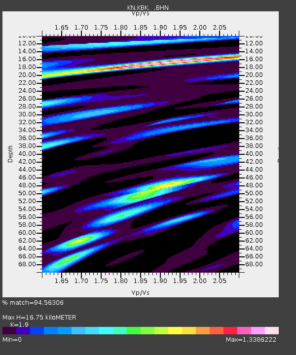
KBK KN.KBK - Earthquake Result Viewer

Earthquake location: Northern Sumatra, Indonesia
Earthquake latitude/longitude: 2.2/96.8
Earthquake time(UTC): 2005/11/19 (323) 14:10:13 GMT
Earthquake Depth: 21 km
Earthquake Magnitude: 6.0 MB, 6.1 MS, 6.5 MW, 6.5 MW
Earthquake Catalog/Contributor: WHDF/NEIC
Network: KN Kyrgyz Seismic Telemetry Network
Station: KBK KN.KBK
Lat/Lon: 42.66 N/74.95 E
Elevation: 1760 m
Distance: 44.8 deg
Az: 337.079 deg
Baz: 148.159 deg
Ray Param: 0.07166665
Estimated Moho Depth: 16.75 km
Estimated Crust Vp/Vs: 1.90
Assumed Crust Vp: 6.306 km/s
Estimated Crust Vs: 3.319 km/s
Estimated Crust Poisson's Ratio: 0.31
Radial Match: 94.56306 %
Radial Bump: 400
Transverse Match: 93.54831 %
Transverse Bump: 400
SOD ConfigId: 2448
Insert Time: 2010-03-08 20:16:03.565 +0000
GWidth: 2.5
Max Bumps: 400
Tol: 0.001

Signal To Noise

ChannelStoNSTALTA
KN:KBK: :BHN:20051119T14:17:54.424012Z2.86912928.119769E-72.8300465E-7
KN:KBK: :BHE:20051119T14:17:54.424012Z4.58983567.821844E-71.7041664E-7
KN:KBK: :BHZ:20051119T14:17:54.424012Z9.4292412.2311199E-62.3661713E-7
Arrivals
Ps2.5 SECOND
PpPs7.3 SECOND
PsPs/PpSs9.8 SECOND