You are here: Home > Network List > US - United States National Seismic Network Stations List
> Station AMTX Amarillo, Texas, USA > Earthquake Result Viewer
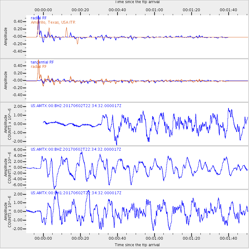
AMTX Amarillo, Texas, USA - Earthquake Result Viewer
*The percent match for this event was below the threshold and hence no stack was calculated.
| Earthquake location: |
Near Islands, Aleutian Islands |
| Earthquake latitude/longitude: |
54.0/170.9 |
| Earthquake time(UTC): |
2017/06/02 (153) 22:24:47 GMT |
| Earthquake Depth: |
8.2 km |
| Earthquake Magnitude: |
6.8 Mww |
| Earthquake Catalog/Contributor: |
NEIC PDE/us |
|
| Network: |
US United States National Seismic Network |
| Station: |
AMTX Amarillo, Texas, USA |
| Lat/Lon: |
34.53 N/101.41 W |
| Elevation: |
1010 m |
|
| Distance: |
61.6 deg |
| Az: |
69.653 deg |
| Baz: |
317.933 deg |
| Ray Param: |
$rayparam |
*The percent match for this event was below the threshold and hence was not used in the summary stack. |
|
| Radial Match: |
96.18552 % |
| Radial Bump: |
362 |
| Transverse Match: |
80.10303 % |
| Transverse Bump: |
400 |
| SOD ConfigId: |
2140511 |
| Insert Time: |
2017-06-16 14:26:56.184 +0000 |
| GWidth: |
2.5 |
| Max Bumps: |
400 |
| Tol: |
0.001 |
|
Signal To Noise
| Channel | StoN | STA | LTA |
| US:AMTX:00:BHZ:20170602T22:34:32.000017Z | 18.350168 | 2.5804895E-6 | 1.4062483E-7 |
| US:AMTX:00:BH1:20170602T22:34:32.000017Z | 6.9937 | 8.945707E-7 | 1.2791094E-7 |
| US:AMTX:00:BH2:20170602T22:34:32.000017Z | 4.931581 | 7.45576E-7 | 1.5118397E-7 |
| Arrivals |
| Ps | |
| PpPs | |
| PsPs/PpSs | |


