You are here: Home > Network List > US - United States National Seismic Network Stations List
> Station MSO Missoula, Montana, USA > Earthquake Result Viewer
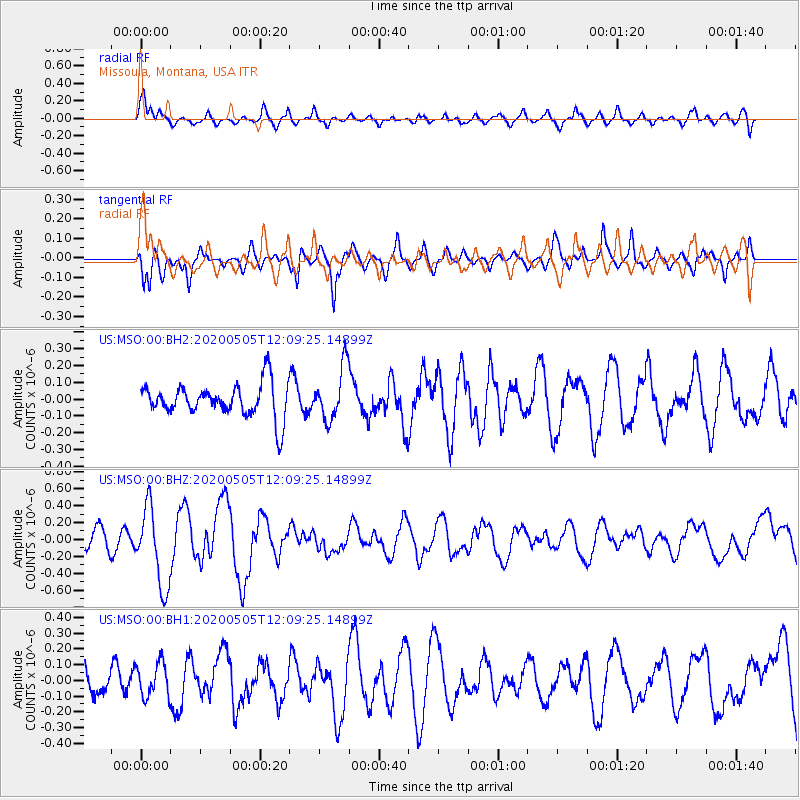
MSO Missoula, Montana, USA - Earthquake Result Viewer
*The percent match for this event was below the threshold and hence no stack was calculated.
| Earthquake location: |
Near Coast Of Guatemala |
| Earthquake latitude/longitude: |
13.3/-91.1 |
| Earthquake time(UTC): |
2020/05/05 (126) 12:02:32 GMT |
| Earthquake Depth: |
8.0 km |
| Earthquake Magnitude: |
5.5 Mww |
| Earthquake Catalog/Contributor: |
NEIC PDE/us |
|
| Network: |
US United States National Seismic Network |
| Station: |
MSO Missoula, Montana, USA |
| Lat/Lon: |
46.83 N/113.94 W |
| Elevation: |
1264 m |
|
| Distance: |
38.5 deg |
| Az: |
334.7 deg |
| Baz: |
142.7 deg |
| Ray Param: |
$rayparam |
*The percent match for this event was below the threshold and hence was not used in the summary stack. |
|
| Radial Match: |
70.684364 % |
| Radial Bump: |
400 |
| Transverse Match: |
64.923454 % |
| Transverse Bump: |
400 |
| SOD ConfigId: |
21166931 |
| Insert Time: |
2020-06-02 12:30:25.330 +0000 |
| GWidth: |
2.5 |
| Max Bumps: |
400 |
| Tol: |
0.001 |
|
Signal To Noise
| Channel | StoN | STA | LTA |
| US:MSO:00:BHZ:20200505T12:09:25.14899Z | 4.293208 | 4.6622026E-7 | 1.0859484E-7 |
| US:MSO:00:BH1:20200505T12:09:25.14899Z | 0.9566045 | 1.0883284E-7 | 1.1376995E-7 |
| US:MSO:00:BH2:20200505T12:09:25.14899Z | 1.5672308 | 1.5563167E-7 | 9.93036E-8 |
| Arrivals |
| Ps | |
| PpPs | |
| PsPs/PpSs | |


