KBK KN.KBK - Earthquake Result Viewer
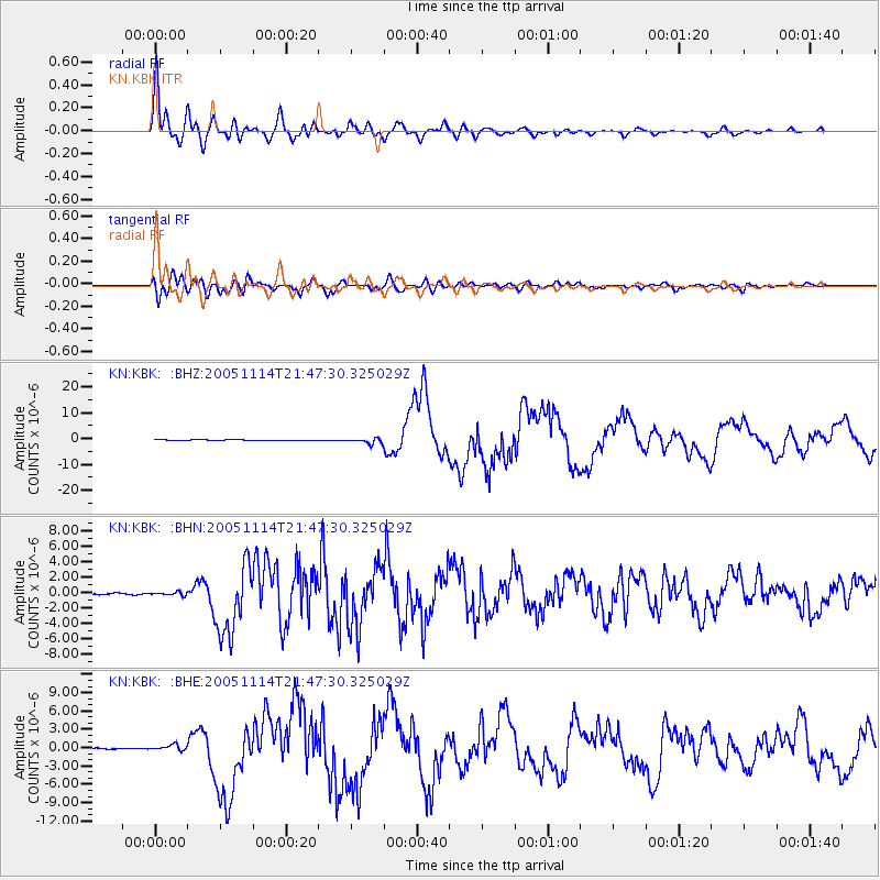
Earthquake location: Off East Coast Of Honshu, Japan
Earthquake latitude/longitude: 38.1/144.9
Earthquake time(UTC): 2005/11/14 (318) 21:38:51 GMT
Earthquake Depth: 11 km
Earthquake Magnitude: 6.7 MB, 6.8 MS, 7.0 MW, 6.9 MW
Earthquake Catalog/Contributor: WHDF/NEIC
Network: KN Kyrgyz Seismic Telemetry Network
Station: KBK KN.KBK
Lat/Lon: 42.66 N/74.95 E
Elevation: 1760 m
Distance: 52.1 deg
Az: 298.557 deg
Baz: 69.93 deg
Ray Param: 0.06698157
Estimated Moho Depth: 15.5 km
Estimated Crust Vp/Vs: 1.61
Assumed Crust Vp: 6.306 km/s
Estimated Crust Vs: 3.911 km/s
Estimated Crust Poisson's Ratio: 0.19
Radial Match: 95.47255 %
Radial Bump: 400
Transverse Match: 87.71194 %
Transverse Bump: 400
SOD ConfigId: 2448
Insert Time: 2010-03-08 20:16:05.827 +0000
GWidth: 2.5
Max Bumps: 400
Tol: 0.001

Signal To Noise

ChannelStoNSTALTA
KN:KBK: :BHN:20051114T21:47:30.325029Z0.920143543.644953E-73.961287E-7
KN:KBK: :BHE:20051114T21:47:30.325029Z2.55940344.5961784E-71.7958007E-7
KN:KBK: :BHZ:20051114T21:47:30.325029Z8.3789231.0661844E-61.27246E-7
Arrivals
Ps1.6 SECOND
PpPs6.1 SECOND
PsPs/PpSs7.7 SECOND