
KBK KN.KBK - Earthquake Result Viewer
| ||||||||||||||||||
| ||||||||||||||||||
| ||||||||||||||||||
|
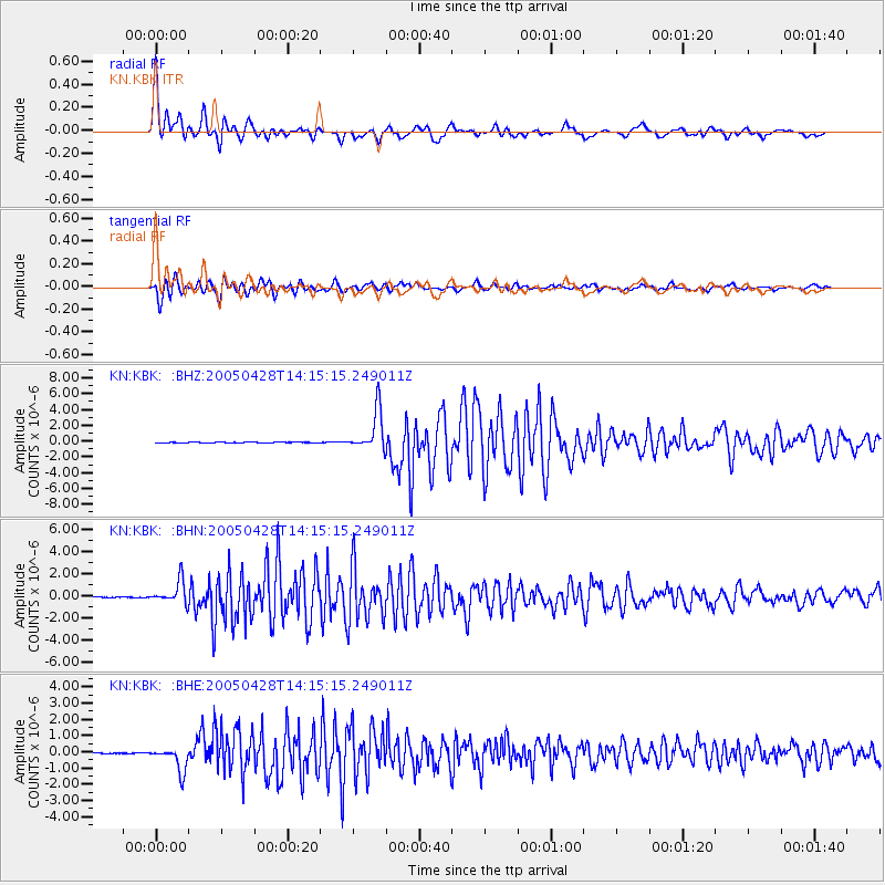
Signal To Noise
| Channel | StoN | STA | LTA |
| KN:KBK: :BHN:20050428T14:15:15.249011Z | 22.075493 | 1.0298162E-6 | 4.664975E-8 |
| KN:KBK: :BHE:20050428T14:15:15.249011Z | 21.934689 | 7.455701E-7 | 3.3990457E-8 |
| KN:KBK: :BHZ:20050428T14:15:15.249011Z | 77.51296 | 2.5408785E-6 | 3.2780047E-8 |
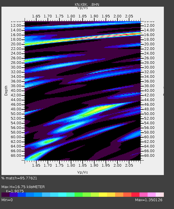
| Arrivals | |
| Ps | 2.6 SECOND |
| PpPs | 7.3 SECOND |
| PsPs/PpSs | 9.8 SECOND |

