KBK KN.KBK - Earthquake Result Viewer
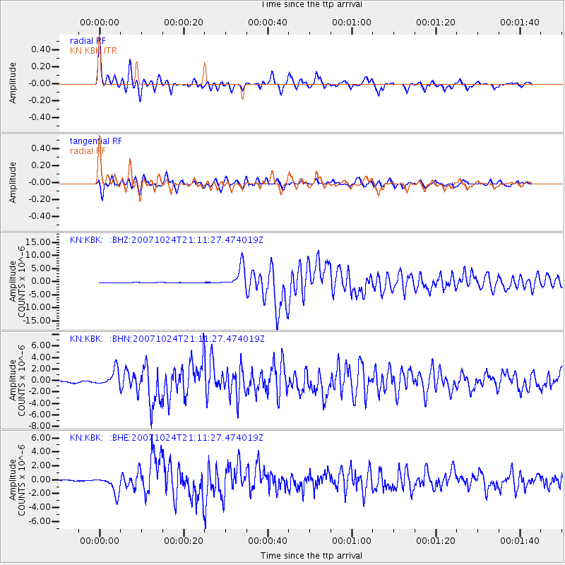
Earthquake location: Southern Sumatra, Indonesia
Earthquake latitude/longitude: -3.9/101.0
Earthquake time(UTC): 2007/10/24 (297) 21:02:50 GMT
Earthquake Depth: 20 km
Earthquake Magnitude: 6.1 MB, 6.9 MS, 6.8 MW, 6.3 ME
Earthquake Catalog/Contributor: WHDF/NEIC
Network: KN Kyrgyz Seismic Telemetry Network
Station: KBK KN.KBK
Lat/Lon: 42.66 N/74.95 E
Elevation: 1760 m
Distance: 52.0 deg
Az: 335.71 deg
Baz: 146.196 deg
Ray Param: 0.06701293
Estimated Moho Depth: 17.75 km
Estimated Crust Vp/Vs: 1.79
Assumed Crust Vp: 6.306 km/s
Estimated Crust Vs: 3.533 km/s
Estimated Crust Poisson's Ratio: 0.27
Radial Match: 95.87359 %
Radial Bump: 400
Transverse Match: 91.28643 %
Transverse Bump: 400
SOD ConfigId: 2564
Insert Time: 2010-03-08 20:17:44.787 +0000
GWidth: 2.5
Max Bumps: 400
Tol: 0.001

Signal To Noise

ChannelStoNSTALTA
KN:KBK: :BHN:20071024T21:11:27.474019Z12.14510251.4780317E-61.2169775E-7
KN:KBK: :BHE:20071024T21:11:27.474019Z12.7462021.2552856E-69.8483106E-8
KN:KBK: :BHZ:20071024T21:11:27.474019Z56.710344.232775E-67.463851E-8
Arrivals
Ps2.3 SECOND
PpPs7.4 SECOND
PsPs/PpSs9.8 SECOND