You are here: Home > Network List > TA - USArray Transportable Network (new EarthScope stations) Stations List
> Station F21K Alatna River, AK, USA > Earthquake Result Viewer
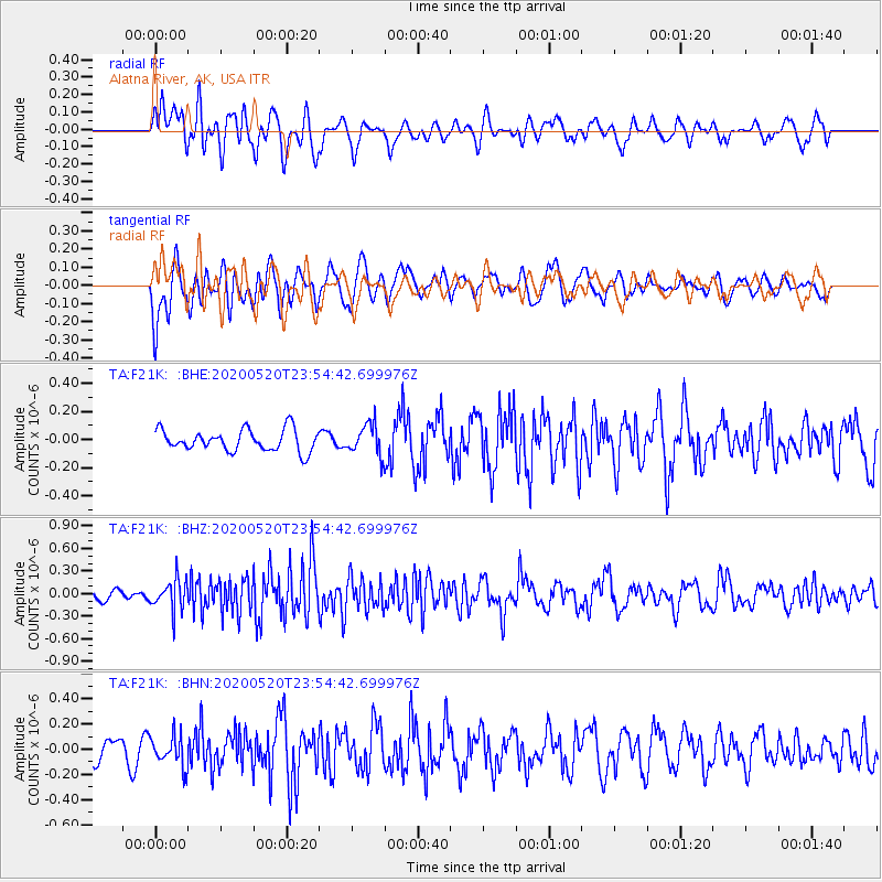
F21K Alatna River, AK, USA - Earthquake Result Viewer
*The percent match for this event was below the threshold and hence no stack was calculated.
| Earthquake location: |
Central Mediterranean Sea |
| Earthquake latitude/longitude: |
35.1/20.3 |
| Earthquake time(UTC): |
2020/05/20 (141) 23:43:17 GMT |
| Earthquake Depth: |
14 km |
| Earthquake Magnitude: |
5.7 mww |
| Earthquake Catalog/Contributor: |
NEIC PDE/us |
|
| Network: |
TA USArray Transportable Network (new EarthScope stations) |
| Station: |
F21K Alatna River, AK, USA |
| Lat/Lon: |
67.22 N/153.48 W |
| Elevation: |
597 m |
|
| Distance: |
77.8 deg |
| Az: |
357.515 deg |
| Baz: |
5.235 deg |
| Ray Param: |
$rayparam |
*The percent match for this event was below the threshold and hence was not used in the summary stack. |
|
| Radial Match: |
53.54173 % |
| Radial Bump: |
400 |
| Transverse Match: |
60.978245 % |
| Transverse Bump: |
400 |
| SOD ConfigId: |
21166931 |
| Insert Time: |
2020-06-04 00:00:49.366 +0000 |
| GWidth: |
2.5 |
| Max Bumps: |
400 |
| Tol: |
0.001 |
|
Signal To Noise
| Channel | StoN | STA | LTA |
| TA:F21K: :BHZ:20200520T23:54:42.699976Z | 2.503422 | 1.9699972E-7 | 7.8692175E-8 |
| TA:F21K: :BHN:20200520T23:54:42.699976Z | 1.1387112 | 1.2179592E-7 | 1.0695944E-7 |
| TA:F21K: :BHE:20200520T23:54:42.699976Z | 1.4533807 | 1.1056258E-7 | 7.607269E-8 |
| Arrivals |
| Ps | |
| PpPs | |
| PsPs/PpSs | |


