KBK KN.KBK - Earthquake Result Viewer
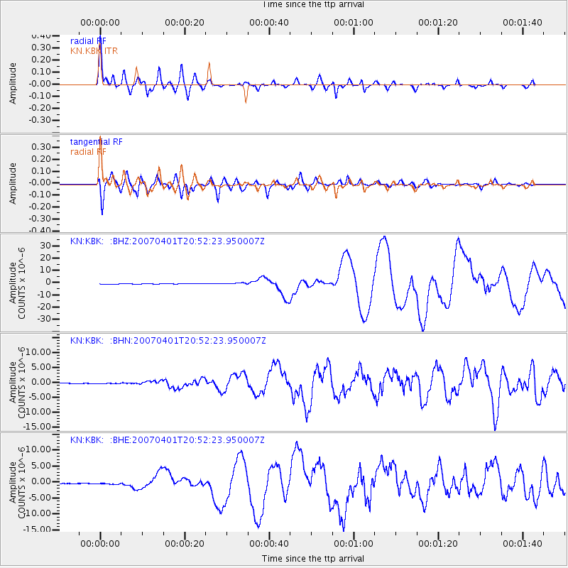
Earthquake location: Solomon Islands
Earthquake latitude/longitude: -8.5/157.0
Earthquake time(UTC): 2007/04/01 (091) 20:39:56 GMT
Earthquake Depth: 10 km
Earthquake Magnitude: 6.8 MB, 7.9 MS, 8.1 MW, 7.7 ME
Earthquake Catalog/Contributor: WHDF/NEIC
Network: KN Kyrgyz Seismic Telemetry Network
Station: KBK KN.KBK
Lat/Lon: 42.66 N/74.95 E
Elevation: 1760 m
Distance: 89.9 deg
Az: 313.056 deg
Baz: 101.517 deg
Ray Param: 0.041711465
Estimated Moho Depth: 44.75 km
Estimated Crust Vp/Vs: 1.76
Assumed Crust Vp: 6.306 km/s
Estimated Crust Vs: 3.583 km/s
Estimated Crust Poisson's Ratio: 0.26
Radial Match: 92.52782 %
Radial Bump: 400
Transverse Match: 91.20207 %
Transverse Bump: 400
SOD ConfigId: 2564
Insert Time: 2010-03-08 20:18:58.314 +0000
GWidth: 2.5
Max Bumps: 400
Tol: 0.001

Signal To Noise

ChannelStoNSTALTA
KN:KBK: :BHN:20070401T20:52:23.950007Z0.831432648.029232E-89.657104E-8
KN:KBK: :BHE:20070401T20:52:23.950007Z2.40277172.628479E-71.09393625E-7
KN:KBK: :BHZ:20070401T20:52:23.950007Z5.803585.666358E-79.7635564E-8
Arrivals
Ps5.5 SECOND
PpPs19 SECOND
PsPs/PpSs25 SECOND