You are here: Home > Network List > TA - USArray Transportable Network (new EarthScope stations) Stations List
> Station I30M Mount Dempster, Yukon, CAN > Earthquake Result Viewer
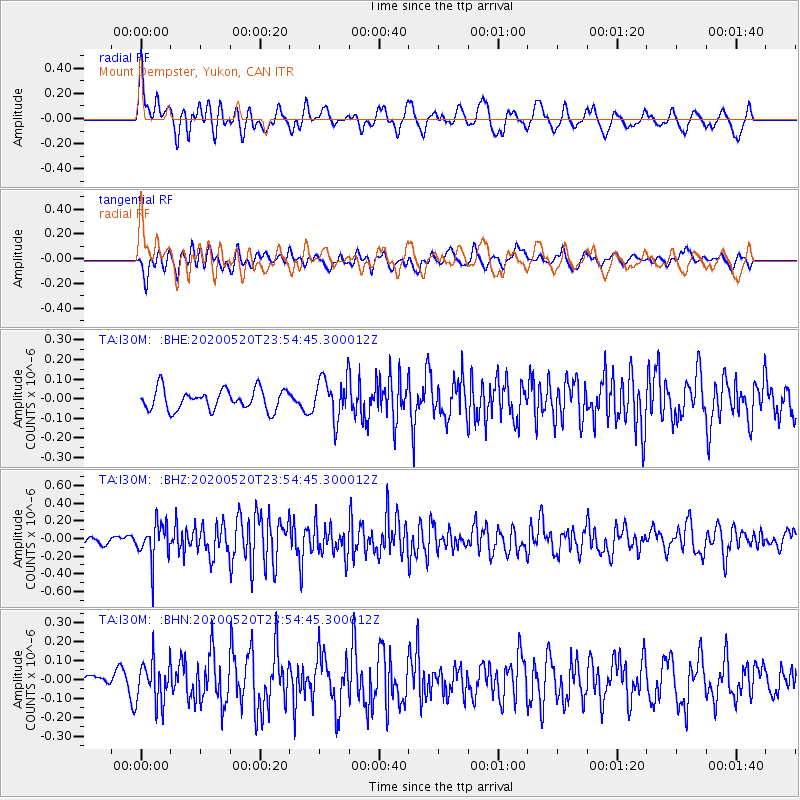
I30M Mount Dempster, Yukon, CAN - Earthquake Result Viewer
*The percent match for this event was below the threshold and hence no stack was calculated.
| Earthquake location: |
Central Mediterranean Sea |
| Earthquake latitude/longitude: |
35.1/20.3 |
| Earthquake time(UTC): |
2020/05/20 (141) 23:43:17 GMT |
| Earthquake Depth: |
14 km |
| Earthquake Magnitude: |
5.7 mww |
| Earthquake Catalog/Contributor: |
NEIC PDE/us |
|
| Network: |
TA USArray Transportable Network (new EarthScope stations) |
| Station: |
I30M Mount Dempster, Yukon, CAN |
| Lat/Lon: |
65.22 N/136.38 W |
| Elevation: |
1399 m |
|
| Distance: |
78.3 deg |
| Az: |
350.177 deg |
| Baz: |
19.374 deg |
| Ray Param: |
$rayparam |
*The percent match for this event was below the threshold and hence was not used in the summary stack. |
|
| Radial Match: |
65.37837 % |
| Radial Bump: |
400 |
| Transverse Match: |
61.74181 % |
| Transverse Bump: |
400 |
| SOD ConfigId: |
21166931 |
| Insert Time: |
2020-06-04 00:01:12.292 +0000 |
| GWidth: |
2.5 |
| Max Bumps: |
400 |
| Tol: |
0.001 |
|
Signal To Noise
| Channel | StoN | STA | LTA |
| TA:I30M: :BHZ:20200520T23:54:45.300012Z | 3.3025353 | 2.08534E-7 | 6.314361E-8 |
| TA:I30M: :BHN:20200520T23:54:45.300012Z | 1.7549558 | 1.1230739E-7 | 6.399443E-8 |
| TA:I30M: :BHE:20200520T23:54:45.300012Z | 2.027131 | 1.0665903E-7 | 5.2615757E-8 |
| Arrivals |
| Ps | |
| PpPs | |
| PsPs/PpSs | |


