KBK KN.KBK - Earthquake Result Viewer
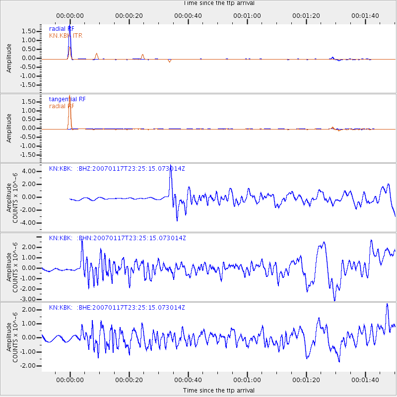
Earthquake location: Carlsberg Ridge
Earthquake latitude/longitude: 10.1/58.7
Earthquake time(UTC): 2007/01/17 (017) 23:18:50 GMT
Earthquake Depth: 10 km
Earthquake Magnitude: 5.8 MB, 5.7 MS, 6.2 MW, 6.1 MW
Earthquake Catalog/Contributor: WHDF/NEIC
Network: KN Kyrgyz Seismic Telemetry Network
Station: KBK KN.KBK
Lat/Lon: 42.66 N/74.95 E
Elevation: 1760 m
Distance: 35.4 deg
Az: 20.88 deg
Baz: 208.405 deg
Ray Param: 0.07725567
Estimated Moho Depth: 64.75 km
Estimated Crust Vp/Vs: 2.05
Assumed Crust Vp: 6.306 km/s
Estimated Crust Vs: 3.084 km/s
Estimated Crust Poisson's Ratio: 0.34
Radial Match: 97.10303 %
Radial Bump: 80
Transverse Match: 30.925032 %
Transverse Bump: 292
SOD ConfigId: 2564
Insert Time: 2010-03-08 20:19:04.815 +0000
GWidth: 2.5
Max Bumps: 400
Tol: 0.001

Signal To Noise

ChannelStoNSTALTA
KN:KBK: :BHN:20070117T23:25:15.073014Z6.1078278.1875334E-71.3404984E-7
KN:KBK: :BHE:20070117T23:25:15.073014Z1.65032393.3427315E-72.0255003E-7
KN:KBK: :BHZ:20070117T23:25:15.073014Z12.3981511.6350486E-61.3187842E-7
Arrivals
Ps11 SECOND
PpPs29 SECOND
PsPs/PpSs41 SECOND