You are here: Home > Network List > US - United States National Seismic Network Stations List
> Station MSO Missoula, Montana, USA > Earthquake Result Viewer
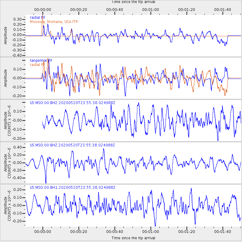
MSO Missoula, Montana, USA - Earthquake Result Viewer
*The percent match for this event was below the threshold and hence no stack was calculated.
| Earthquake location: |
Central Mediterranean Sea |
| Earthquake latitude/longitude: |
35.1/20.3 |
| Earthquake time(UTC): |
2020/05/20 (141) 23:43:17 GMT |
| Earthquake Depth: |
14 km |
| Earthquake Magnitude: |
5.7 mww |
| Earthquake Catalog/Contributor: |
NEIC PDE/us |
|
| Network: |
US United States National Seismic Network |
| Station: |
MSO Missoula, Montana, USA |
| Lat/Lon: |
46.83 N/113.94 W |
| Elevation: |
1264 m |
|
| Distance: |
88.6 deg |
| Az: |
330.507 deg |
| Baz: |
35.985 deg |
| Ray Param: |
$rayparam |
*The percent match for this event was below the threshold and hence was not used in the summary stack. |
|
| Radial Match: |
68.64535 % |
| Radial Bump: |
400 |
| Transverse Match: |
59.885414 % |
| Transverse Bump: |
400 |
| SOD ConfigId: |
21166931 |
| Insert Time: |
2020-06-04 00:03:51.954 +0000 |
| GWidth: |
2.5 |
| Max Bumps: |
400 |
| Tol: |
0.001 |
|
Signal To Noise
| Channel | StoN | STA | LTA |
| US:MSO:00:BHZ:20200520T23:55:38.024988Z | 1.9706563 | 1.9218434E-7 | 9.752302E-8 |
| US:MSO:00:BH1:20200520T23:55:38.024988Z | 1.0844162 | 6.952018E-8 | 6.410839E-8 |
| US:MSO:00:BH2:20200520T23:55:38.024988Z | 1.2447191 | 7.6377525E-8 | 6.136125E-8 |
| Arrivals |
| Ps | |
| PpPs | |
| PsPs/PpSs | |


