You are here: Home > Network List > US - United States National Seismic Network Stations List
> Station WMOK Wichita Mountains, Oklahoma, USA > Earthquake Result Viewer
WMOK Wichita Mountains, Oklahoma, USA - Earthquake Result Viewer
*The percent match for this event was below the threshold and hence no stack was calculated.
| Earthquake location: |
Central Mediterranean Sea |
| Earthquake latitude/longitude: |
35.1/20.3 |
| Earthquake time(UTC): |
2020/05/20 (141) 23:43:17 GMT |
| Earthquake Depth: |
14 km |
| Earthquake Magnitude: |
5.7 mww |
| Earthquake Catalog/Contributor: |
NEIC PDE/us |
|
| Network: |
US United States National Seismic Network |
| Station: |
WMOK Wichita Mountains, Oklahoma, USA |
| Lat/Lon: |
34.74 N/98.78 W |
| Elevation: |
486 m |
|
| Distance: |
90.1 deg |
| Az: |
313.95 deg |
| Baz: |
45.757 deg |
| Ray Param: |
$rayparam |
*The percent match for this event was below the threshold and hence was not used in the summary stack. |
|
| Radial Match: |
30.295511 % |
| Radial Bump: |
400 |
| Transverse Match: |
30.924828 % |
| Transverse Bump: |
400 |
| SOD ConfigId: |
21166931 |
| Insert Time: |
2020-06-04 00:04:01.260 +0000 |
| GWidth: |
2.5 |
| Max Bumps: |
400 |
| Tol: |
0.001 |
|
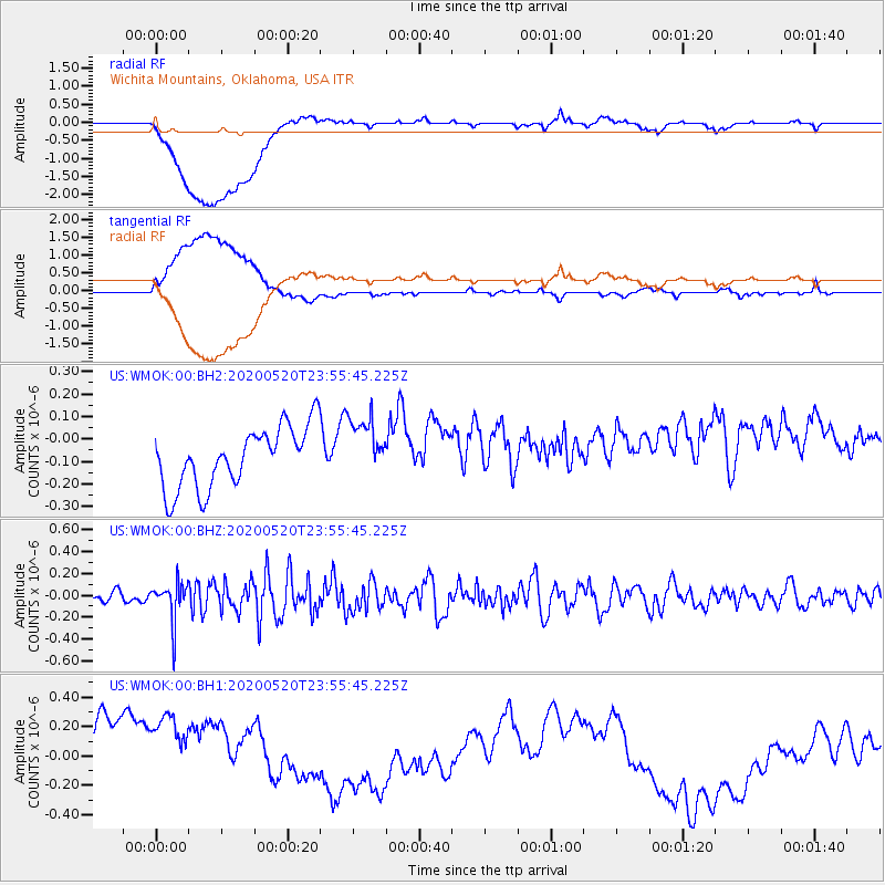
Signal To Noise
| Channel | StoN | STA | LTA |
| US:WMOK:00:BHZ:20200520T23:55:45.225Z | 2.6240013 | 1.7683402E-7 | 6.739098E-8 |
| US:WMOK:00:BH1:20200520T23:55:45.225Z | 1.1353711 | 6.105796E-7 | 5.377798E-7 |
| US:WMOK:00:BH2:20200520T23:55:45.225Z | 1.0111634 | 1.3496114E-7 | 1.3347115E-7 |
| Arrivals |
| Ps | |
| PpPs | |
| PsPs/PpSs | |


