
KBK KN.KBK - Earthquake Result Viewer
| ||||||||||||||||||
| ||||||||||||||||||
| ||||||||||||||||||
|
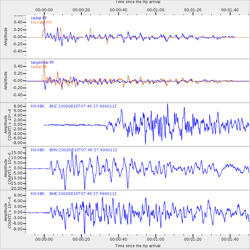
Signal To Noise
| Channel | StoN | STA | LTA |
| KN:KBK: :BHN:20090816T07:46:37.499011Z | 31.708506 | 2.649628E-6 | 8.356206E-8 |
| KN:KBK: :BHE:20090816T07:46:37.499011Z | 13.640203 | 1.0621383E-6 | 7.786821E-8 |
| KN:KBK: :BHZ:20090816T07:46:37.499011Z | 6.6148 | 6.739751E-7 | 1.0188896E-7 |
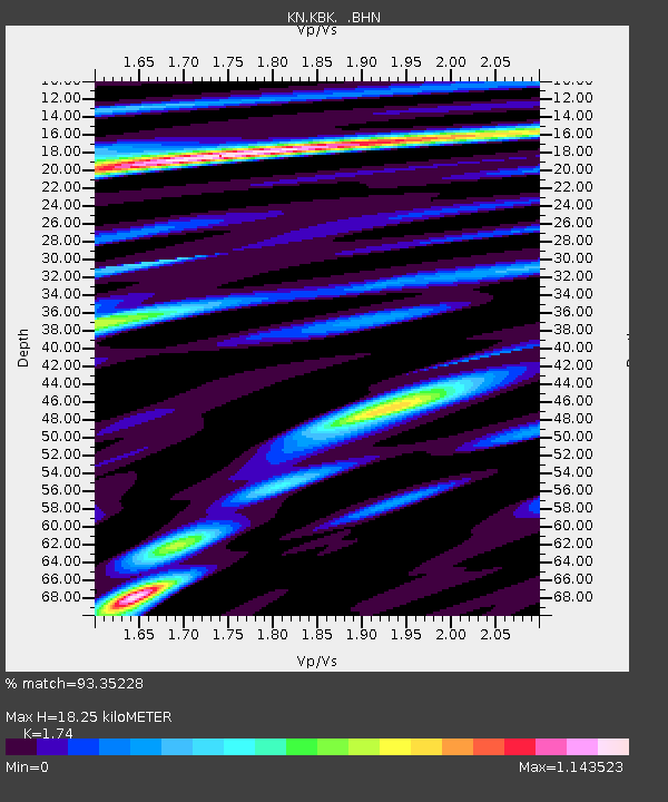
| Arrivals | |
| Ps | 2.3 SECOND |
| PpPs | 7.5 SECOND |
| PsPs/PpSs | 9.8 SECOND |

