You are here: Home > Network List > KN - Kyrgyz Seismic Telemetry Network Stations List
> Station KBK KN.KBK > Earthquake Result Viewer
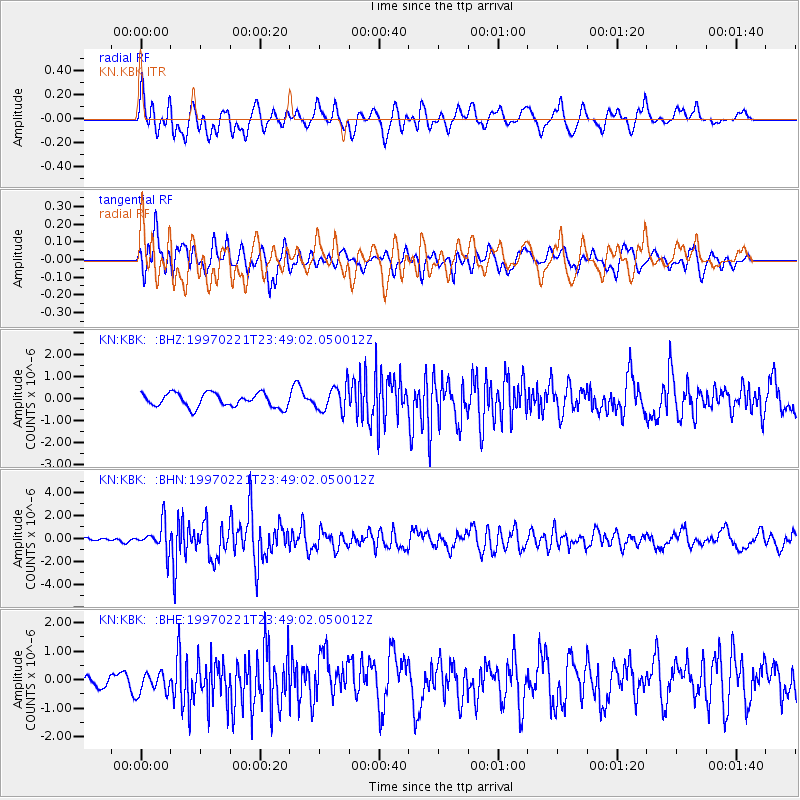
KBK KN.KBK - Earthquake Result Viewer
*The percent match for this event was below the threshold and hence no stack was calculated.
| Earthquake location: |
East Of Kuril Islands |
| Earthquake latitude/longitude: |
43.8/149.2 |
| Earthquake time(UTC): |
1997/02/21 (052) 23:40:24 GMT |
| Earthquake Depth: |
33 km |
| Earthquake Magnitude: |
6.1 MB, 5.6 MS, 6.1 UNKNOWN, 6.1 MW |
| Earthquake Catalog/Contributor: |
WHDF/NEIC |
|
| Network: |
KN Kyrgyz Seismic Telemetry Network |
| Station: |
KBK KN.KBK |
| Lat/Lon: |
42.66 N/74.95 E |
| Elevation: |
1760 m |
|
| Distance: |
52.3 deg |
| Az: |
296.256 deg |
| Baz: |
61.624 deg |
| Ray Param: |
$rayparam |
*The percent match for this event was below the threshold and hence was not used in the summary stack. |
|
| Radial Match: |
76.87211 % |
| Radial Bump: |
400 |
| Transverse Match: |
67.728714 % |
| Transverse Bump: |
400 |
| SOD ConfigId: |
4480 |
| Insert Time: |
2010-03-08 20:21:17.744 +0000 |
| GWidth: |
2.5 |
| Max Bumps: |
400 |
| Tol: |
0.001 |
|
Signal To Noise
| Channel | StoN | STA | LTA |
| KN:KBK: :BHN:19970221T23:49:02.050012Z | 5.8376327 | 1.2140374E-6 | 2.0796742E-7 |
| KN:KBK: :BHE:19970221T23:49:02.050012Z | 2.0424597 | 3.9039273E-7 | 1.9113854E-7 |
| KN:KBK: :BHZ:19970221T23:49:02.050012Z | 1.8816215 | 5.7996425E-7 | 3.082258E-7 |
| Arrivals |
| Ps | |
| PpPs | |
| PsPs/PpSs | |


