You are here: Home > Network List > TA - USArray Transportable Network (new EarthScope stations) Stations List
> Station E18K Tukpahlearik Creek, AK, USA > Earthquake Result Viewer
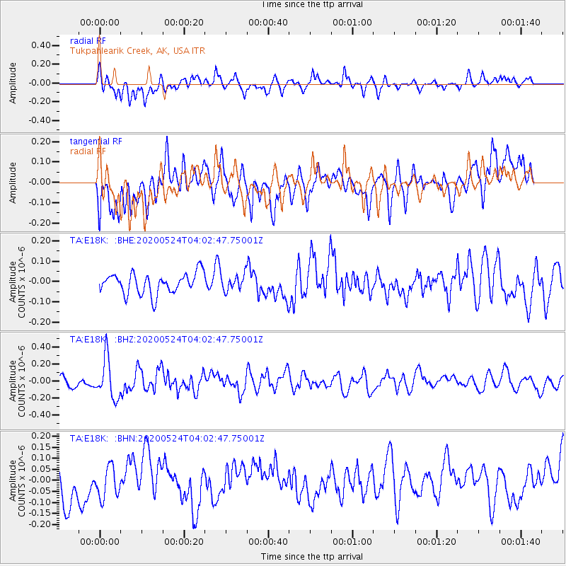
E18K Tukpahlearik Creek, AK, USA - Earthquake Result Viewer
*The percent match for this event was below the threshold and hence no stack was calculated.
| Earthquake location: |
Near Coast Of Chiapas, Mexico |
| Earthquake latitude/longitude: |
14.7/-93.8 |
| Earthquake time(UTC): |
2020/05/24 (145) 03:52:22 GMT |
| Earthquake Depth: |
16 km |
| Earthquake Magnitude: |
5.5 Mww |
| Earthquake Catalog/Contributor: |
NEIC PDE/us |
|
| Network: |
TA USArray Transportable Network (new EarthScope stations) |
| Station: |
E18K Tukpahlearik Creek, AK, USA |
| Lat/Lon: |
67.42 N/160.60 W |
| Elevation: |
297 m |
|
| Distance: |
67.7 deg |
| Az: |
337.437 deg |
| Baz: |
105.932 deg |
| Ray Param: |
$rayparam |
*The percent match for this event was below the threshold and hence was not used in the summary stack. |
|
| Radial Match: |
62.136463 % |
| Radial Bump: |
384 |
| Transverse Match: |
56.018517 % |
| Transverse Bump: |
400 |
| SOD ConfigId: |
21166931 |
| Insert Time: |
2020-06-07 04:04:03.895 +0000 |
| GWidth: |
2.5 |
| Max Bumps: |
400 |
| Tol: |
0.001 |
|
Signal To Noise
| Channel | StoN | STA | LTA |
| TA:E18K: :BHZ:20200524T04:02:47.75001Z | 3.228073 | 2.4356447E-7 | 7.545197E-8 |
| TA:E18K: :BHN:20200524T04:02:47.75001Z | 0.8240184 | 7.315569E-8 | 8.877919E-8 |
| TA:E18K: :BHE:20200524T04:02:47.75001Z | 0.7395786 | 3.7653326E-8 | 5.091186E-8 |
| Arrivals |
| Ps | |
| PpPs | |
| PsPs/PpSs | |


