You are here: Home > Network List > PF - Volcanologic Network of Piton de Fournaise-OVPF Stations List
> Station FRE Station Sismologique des Fonds de la Riviere de l'Est > Earthquake Result Viewer
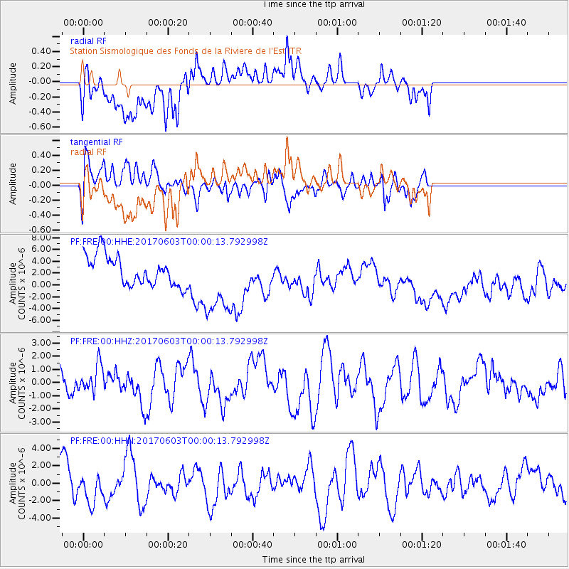
FRE Station Sismologique des Fonds de la Riviere de l'Est - Earthquake Result Viewer
*The percent match for this event was below the threshold and hence no stack was calculated.
| Earthquake location: |
Near N Coast Of New Guinea, P.N.G. |
| Earthquake latitude/longitude: |
-4.7/145.1 |
| Earthquake time(UTC): |
2017/06/02 (153) 23:48:17 GMT |
| Earthquake Depth: |
194 km |
| Earthquake Magnitude: |
5.9 Mww |
| Earthquake Catalog/Contributor: |
NEIC PDE/us |
|
| Network: |
PF Volcanologic Network of Piton de Fournaise-OVPF |
| Station: |
FRE Station Sismologique des Fonds de la Riviere de l'Est |
| Lat/Lon: |
21.20 S/55.70 E |
| Elevation: |
1775 m |
|
| Distance: |
87.8 deg |
| Az: |
249.032 deg |
| Baz: |
94.195 deg |
| Ray Param: |
$rayparam |
*The percent match for this event was below the threshold and hence was not used in the summary stack. |
|
| Radial Match: |
31.975538 % |
| Radial Bump: |
400 |
| Transverse Match: |
50.062088 % |
| Transverse Bump: |
400 |
| SOD ConfigId: |
2140511 |
| Insert Time: |
2017-06-16 15:42:29.170 +0000 |
| GWidth: |
2.5 |
| Max Bumps: |
400 |
| Tol: |
0.001 |
|
Signal To Noise
| Channel | StoN | STA | LTA |
| PF:FRE:00:HHZ:20170603T00:00:13.792998Z | 0.70451826 | 1.1019467E-6 | 1.5641139E-6 |
| PF:FRE:00:HHN:20170603T00:00:13.792998Z | 0.9501592 | 1.6778274E-6 | 1.7658381E-6 |
| PF:FRE:00:HHE:20170603T00:00:13.792998Z | 2.3865905 | 5.9885447E-6 | 2.509247E-6 |
| Arrivals |
| Ps | |
| PpPs | |
| PsPs/PpSs | |


