You are here: Home > Network List > G - GEOSCOPE Stations List
> Station WUS Wushi, Xinjiang Uygur, China > Earthquake Result Viewer
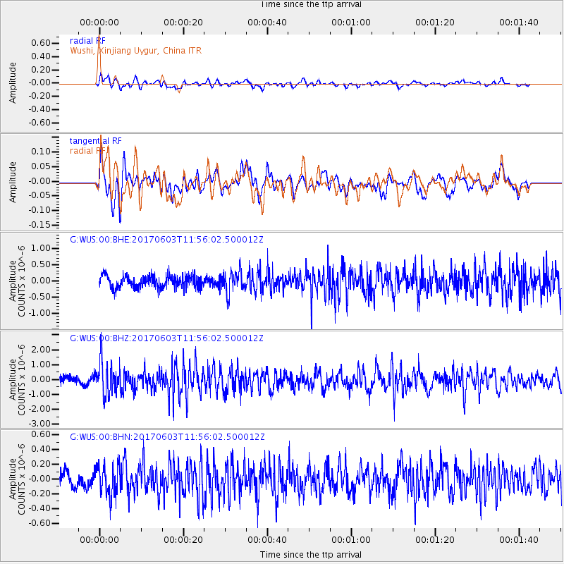
WUS Wushi, Xinjiang Uygur, China - Earthquake Result Viewer
*The percent match for this event was below the threshold and hence no stack was calculated.
| Earthquake location: |
Kuril Islands |
| Earthquake latitude/longitude: |
50.9/157.3 |
| Earthquake time(UTC): |
2017/06/03 (154) 11:47:23 GMT |
| Earthquake Depth: |
44 km |
| Earthquake Magnitude: |
5.1 Mww |
| Earthquake Catalog/Contributor: |
NEIC PDE/us |
|
| Network: |
G GEOSCOPE |
| Station: |
WUS Wushi, Xinjiang Uygur, China |
| Lat/Lon: |
41.20 N/79.22 E |
| Elevation: |
1457 m |
|
| Distance: |
52.7 deg |
| Az: |
291.78 deg |
| Baz: |
51.239 deg |
| Ray Param: |
$rayparam |
*The percent match for this event was below the threshold and hence was not used in the summary stack. |
|
| Radial Match: |
65.06075 % |
| Radial Bump: |
400 |
| Transverse Match: |
63.620476 % |
| Transverse Bump: |
400 |
| SOD ConfigId: |
2140511 |
| Insert Time: |
2017-06-17 03:45:48.206 +0000 |
| GWidth: |
2.5 |
| Max Bumps: |
400 |
| Tol: |
0.001 |
|
Signal To Noise
| Channel | StoN | STA | LTA |
| G:WUS:00:BHZ:20170603T11:56:02.500012Z | 4.161482 | 1.1155113E-6 | 2.6805625E-7 |
| G:WUS:00:BHN:20170603T11:56:02.500012Z | 2.6303563 | 2.0350984E-7 | 7.7369684E-8 |
| G:WUS:00:BHE:20170603T11:56:02.500012Z | 1.7671429 | 3.3195784E-7 | 1.8785003E-7 |
| Arrivals |
| Ps | |
| PpPs | |
| PsPs/PpSs | |


