You are here: Home > Network List > US - United States National Seismic Network Stations List
> Station EGMT Eagleton, Montana, USA > Earthquake Result Viewer
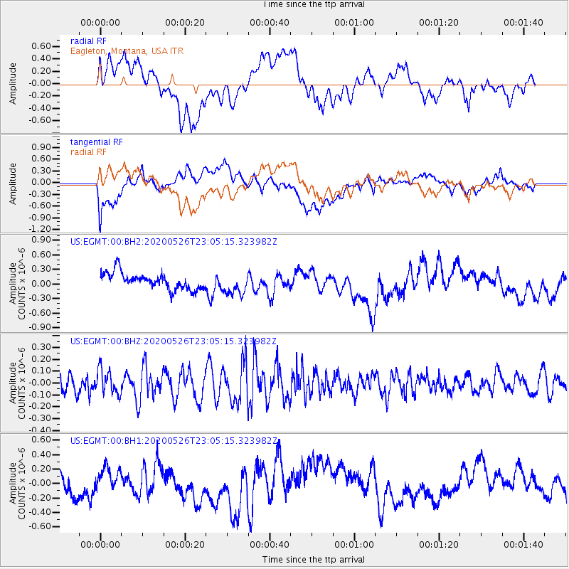
EGMT Eagleton, Montana, USA - Earthquake Result Viewer
*The percent match for this event was below the threshold and hence no stack was calculated.
| Earthquake location: |
Vanuatu Islands |
| Earthquake latitude/longitude: |
-17.0/167.8 |
| Earthquake time(UTC): |
2020/05/26 (147) 22:52:12 GMT |
| Earthquake Depth: |
9.7 km |
| Earthquake Magnitude: |
5.6 Mww |
| Earthquake Catalog/Contributor: |
NEIC PDE/us |
|
| Network: |
US United States National Seismic Network |
| Station: |
EGMT Eagleton, Montana, USA |
| Lat/Lon: |
48.02 N/109.75 W |
| Elevation: |
1055 m |
|
| Distance: |
97.5 deg |
| Az: |
42.159 deg |
| Baz: |
253.038 deg |
| Ray Param: |
$rayparam |
*The percent match for this event was below the threshold and hence was not used in the summary stack. |
|
| Radial Match: |
27.011526 % |
| Radial Bump: |
400 |
| Transverse Match: |
61.346943 % |
| Transverse Bump: |
400 |
| SOD ConfigId: |
21166931 |
| Insert Time: |
2020-06-09 23:02:37.452 +0000 |
| GWidth: |
2.5 |
| Max Bumps: |
400 |
| Tol: |
0.001 |
|
Signal To Noise
| Channel | StoN | STA | LTA |
| US:EGMT:00:BHZ:20200526T23:05:15.323982Z | 1.2389677 | 1.0455533E-7 | 8.438907E-8 |
| US:EGMT:00:BH1:20200526T23:05:15.323982Z | 1.0471246 | 1.395655E-7 | 1.3328452E-7 |
| US:EGMT:00:BH2:20200526T23:05:15.323982Z | 1.3306594 | 2.2629513E-7 | 1.7006239E-7 |
| Arrivals |
| Ps | |
| PpPs | |
| PsPs/PpSs | |


