You are here: Home > Network List > IU - Global Seismograph Network (GSN - IRIS/USGS) Stations List
> Station CCM Cathedral Cave, Missouri, USA > Earthquake Result Viewer
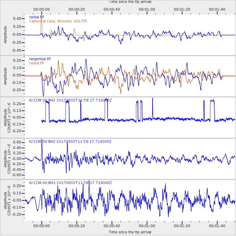
CCM Cathedral Cave, Missouri, USA - Earthquake Result Viewer
*The percent match for this event was below the threshold and hence no stack was calculated.
| Earthquake location: |
Kuril Islands |
| Earthquake latitude/longitude: |
50.9/157.3 |
| Earthquake time(UTC): |
2017/06/03 (154) 11:47:23 GMT |
| Earthquake Depth: |
44 km |
| Earthquake Magnitude: |
5.1 Mww |
| Earthquake Catalog/Contributor: |
NEIC PDE/us |
|
| Network: |
IU Global Seismograph Network (GSN - IRIS/USGS) |
| Station: |
CCM Cathedral Cave, Missouri, USA |
| Lat/Lon: |
38.06 N/91.24 W |
| Elevation: |
222 m |
|
| Distance: |
73.0 deg |
| Az: |
50.175 deg |
| Baz: |
321.941 deg |
| Ray Param: |
$rayparam |
*The percent match for this event was below the threshold and hence was not used in the summary stack. |
|
| Radial Match: |
41.192535 % |
| Radial Bump: |
400 |
| Transverse Match: |
50.337265 % |
| Transverse Bump: |
400 |
| SOD ConfigId: |
2140511 |
| Insert Time: |
2017-06-17 03:46:51.911 +0000 |
| GWidth: |
2.5 |
| Max Bumps: |
400 |
| Tol: |
0.001 |
|
Signal To Noise
| Channel | StoN | STA | LTA |
| IU:CCM:00:BHZ:20170603T11:58:17.719006Z | 3.1684365 | 2.3365295E-7 | 7.374393E-8 |
| IU:CCM:00:BH1:20170603T11:58:17.719006Z | 1.6756946 | 7.890995E-8 | 4.709089E-8 |
| IU:CCM:00:BH2:20170603T11:58:17.719006Z | 0.24040742 | 2.5524248E-8 | 1.06170795E-7 |
| Arrivals |
| Ps | |
| PpPs | |
| PsPs/PpSs | |


