You are here: Home > Network List > G - GEOSCOPE Stations List
> Station INU Inuyama, Japan > Earthquake Result Viewer
INU Inuyama, Japan - Earthquake Result Viewer

| Earthquake location: |
Vanuatu Islands |
| Earthquake latitude/longitude: |
-17.2/167.9 |
| Earthquake time(UTC): |
2020/05/27 (148) 07:09:10 GMT |
| Earthquake Depth: |
10 km |
| Earthquake Magnitude: |
6.1 mww |
| Earthquake Catalog/Contributor: |
NEIC PDE/us |
|
| Network: |
G GEOSCOPE |
| Station: |
INU Inuyama, Japan |
| Lat/Lon: |
35.35 N/137.03 E |
| Elevation: |
132 m |
|
| Distance: |
59.9 deg |
| Az: |
331.018 deg |
| Baz: |
145.48 deg |
| Ray Param: |
0.061913453 |
| Estimated Moho Depth: |
19.5 km |
| Estimated Crust Vp/Vs: |
2.08 |
| Assumed Crust Vp: |
6.461 km/s |
| Estimated Crust Vs: |
3.103 km/s |
| Estimated Crust Poisson's Ratio: |
0.35 |
|
| Radial Match: |
91.892075 % |
| Radial Bump: |
400 |
| Transverse Match: |
84.29138 % |
| Transverse Bump: |
400 |
| SOD ConfigId: |
21166931 |
| Insert Time: |
2020-06-10 07:16:02.662 +0000 |
| GWidth: |
2.5 |
| Max Bumps: |
400 |
| Tol: |
0.001 |
|
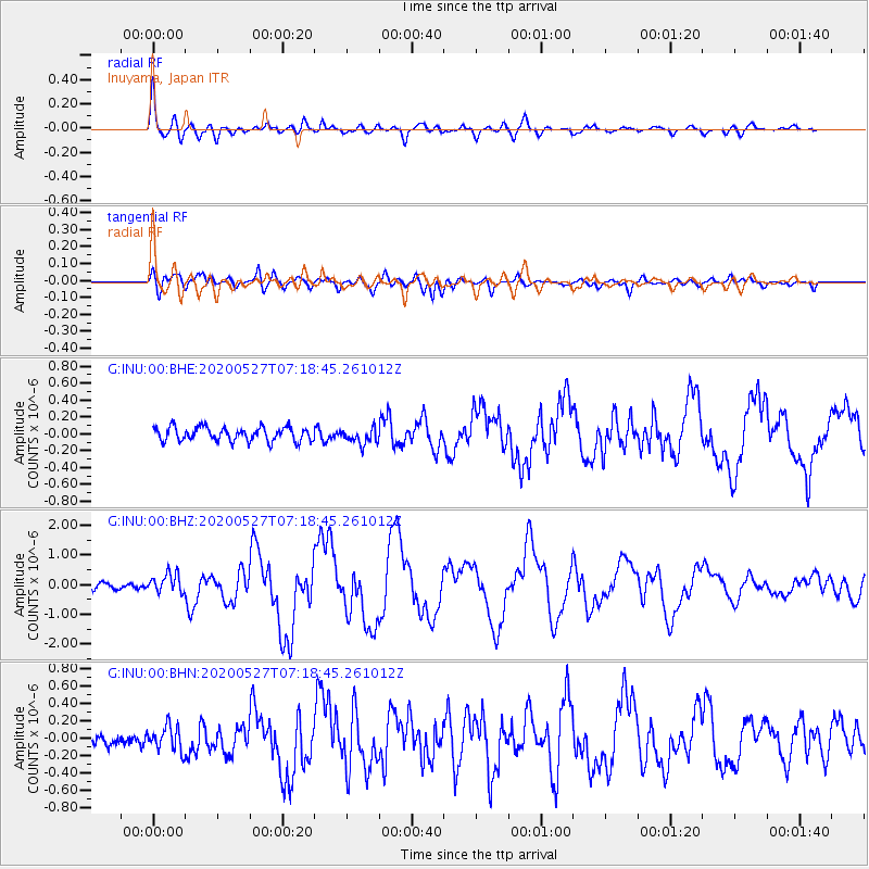
Signal To Noise
| Channel | StoN | STA | LTA |
| G:INU:00:BHZ:20200527T07:18:45.261012Z | 4.0385866 | 3.2945584E-7 | 8.157702E-8 |
| G:INU:00:BHN:20200527T07:18:45.261012Z | 2.0511198 | 1.4334174E-7 | 6.988462E-8 |
| G:INU:00:BHE:20200527T07:18:45.261012Z | 1.1719345 | 9.534763E-8 | 8.135919E-8 |
| Arrivals |
| Ps | 3.4 SECOND |
| PpPs | 8.9 SECOND |
| PsPs/PpSs | 12 SECOND |


