You are here: Home > Network List > CN - Canadian National Seismograph Network Stations List
> Station INK INUVIK, NT > Earthquake Result Viewer
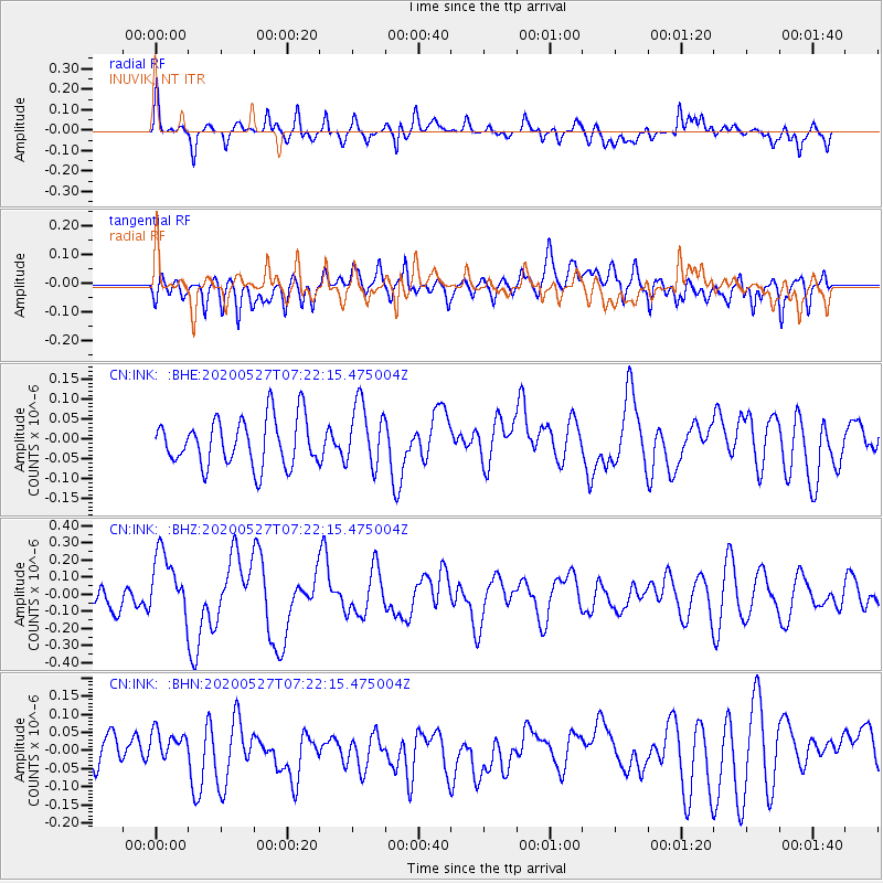
INK INUVIK, NT - Earthquake Result Viewer
*The percent match for this event was below the threshold and hence no stack was calculated.
| Earthquake location: |
Vanuatu Islands |
| Earthquake latitude/longitude: |
-18.7/168.1 |
| Earthquake time(UTC): |
2020/05/27 (148) 07:09:18 GMT |
| Earthquake Depth: |
10 km |
| Earthquake Magnitude: |
6.1 Mww |
| Earthquake Catalog/Contributor: |
NEIC PDE/us |
|
| Network: |
CN Canadian National Seismograph Network |
| Station: |
INK INUVIK, NT |
| Lat/Lon: |
68.31 N/133.53 W |
| Elevation: |
44 m |
|
| Distance: |
96.4 deg |
| Az: |
18.576 deg |
| Baz: |
234.291 deg |
| Ray Param: |
$rayparam |
*The percent match for this event was below the threshold and hence was not used in the summary stack. |
|
| Radial Match: |
69.50122 % |
| Radial Bump: |
400 |
| Transverse Match: |
56.091156 % |
| Transverse Bump: |
400 |
| SOD ConfigId: |
21166931 |
| Insert Time: |
2020-06-10 07:31:27.574 +0000 |
| GWidth: |
2.5 |
| Max Bumps: |
400 |
| Tol: |
0.001 |
|
Signal To Noise
| Channel | StoN | STA | LTA |
| CN:INK: :BHZ:20200527T07:22:15.475004Z | 2.252843 | 1.8927017E-7 | 8.401392E-8 |
| CN:INK: :BHN:20200527T07:22:15.475004Z | 1.0225761 | 3.7981163E-8 | 3.714263E-8 |
| CN:INK: :BHE:20200527T07:22:15.475004Z | 1.3223828 | 7.897945E-8 | 5.9725096E-8 |
| Arrivals |
| Ps | |
| PpPs | |
| PsPs/PpSs | |


