You are here: Home > Network List > US - United States National Seismic Network Stations List
> Station AMTX Amarillo, Texas, USA > Earthquake Result Viewer
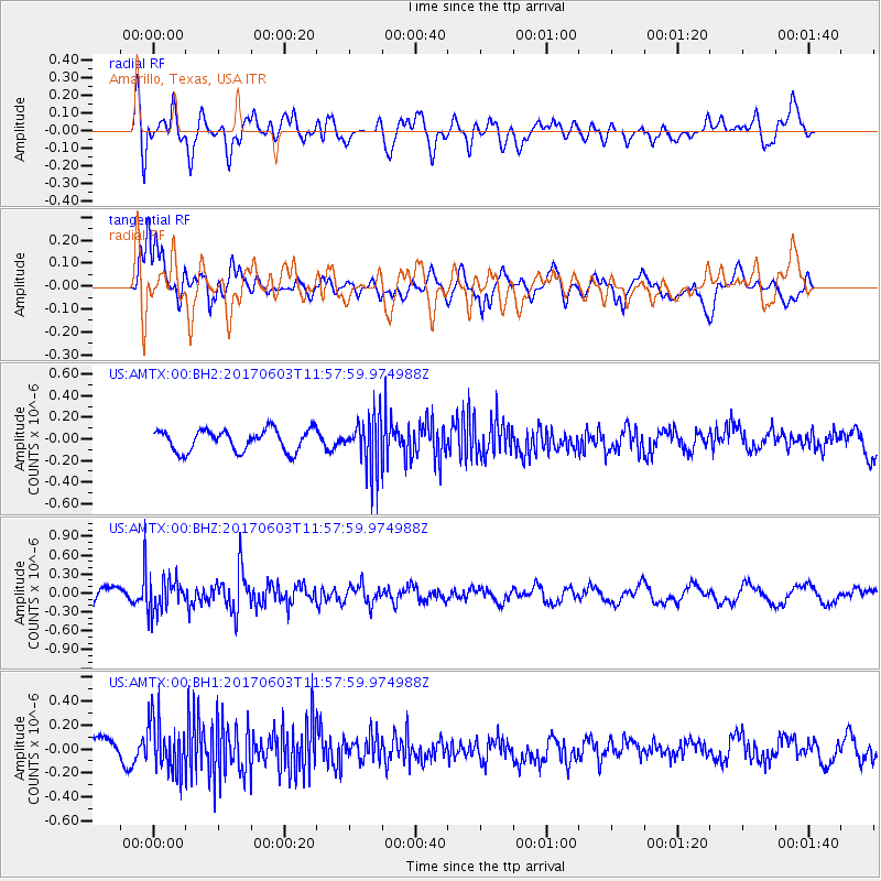
AMTX Amarillo, Texas, USA - Earthquake Result Viewer
*The percent match for this event was below the threshold and hence no stack was calculated.
| Earthquake location: |
Kuril Islands |
| Earthquake latitude/longitude: |
50.9/157.3 |
| Earthquake time(UTC): |
2017/06/03 (154) 11:47:23 GMT |
| Earthquake Depth: |
44 km |
| Earthquake Magnitude: |
5.1 Mww |
| Earthquake Catalog/Contributor: |
NEIC PDE/us |
|
| Network: |
US United States National Seismic Network |
| Station: |
AMTX Amarillo, Texas, USA |
| Lat/Lon: |
34.53 N/101.41 W |
| Elevation: |
1010 m |
|
| Distance: |
70.5 deg |
| Az: |
59.186 deg |
| Baz: |
318.764 deg |
| Ray Param: |
$rayparam |
*The percent match for this event was below the threshold and hence was not used in the summary stack. |
|
| Radial Match: |
58.689724 % |
| Radial Bump: |
400 |
| Transverse Match: |
72.64341 % |
| Transverse Bump: |
400 |
| SOD ConfigId: |
2140511 |
| Insert Time: |
2017-06-17 03:49:48.041 +0000 |
| GWidth: |
2.5 |
| Max Bumps: |
400 |
| Tol: |
0.001 |
|
Signal To Noise
| Channel | StoN | STA | LTA |
| US:AMTX:00:BHZ:20170603T11:57:59.974988Z | 1.9159099 | 2.5138132E-7 | 1.3120727E-7 |
| US:AMTX:00:BH1:20170603T11:57:59.974988Z | 2.5350668 | 2.239053E-7 | 8.832323E-8 |
| US:AMTX:00:BH2:20170603T11:57:59.974988Z | 2.7897666 | 2.7809452E-7 | 9.9683795E-8 |
| Arrivals |
| Ps | |
| PpPs | |
| PsPs/PpSs | |


