You are here: Home > Network List > TA - USArray Transportable Network (new EarthScope stations) Stations List
> Station F26K Sheenjek River, AK, USA > Earthquake Result Viewer
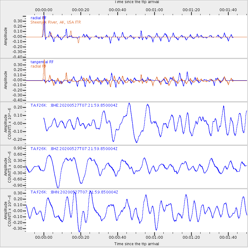
F26K Sheenjek River, AK, USA - Earthquake Result Viewer
*The percent match for this event was below the threshold and hence no stack was calculated.
| Earthquake location: |
Vanuatu Islands |
| Earthquake latitude/longitude: |
-18.7/168.1 |
| Earthquake time(UTC): |
2020/05/27 (148) 07:09:18 GMT |
| Earthquake Depth: |
10 km |
| Earthquake Magnitude: |
6.1 Mww |
| Earthquake Catalog/Contributor: |
NEIC PDE/us |
|
| Network: |
TA USArray Transportable Network (new EarthScope stations) |
| Station: |
F26K Sheenjek River, AK, USA |
| Lat/Lon: |
67.69 N/144.15 W |
| Elevation: |
683 m |
|
| Distance: |
93.0 deg |
| Az: |
16.436 deg |
| Baz: |
224.624 deg |
| Ray Param: |
$rayparam |
*The percent match for this event was below the threshold and hence was not used in the summary stack. |
|
| Radial Match: |
79.48479 % |
| Radial Bump: |
400 |
| Transverse Match: |
55.67701 % |
| Transverse Bump: |
400 |
| SOD ConfigId: |
21166931 |
| Insert Time: |
2020-06-10 07:37:10.998 +0000 |
| GWidth: |
2.5 |
| Max Bumps: |
400 |
| Tol: |
0.001 |
|
Signal To Noise
| Channel | StoN | STA | LTA |
| TA:F26K: :BHZ:20200527T07:21:59.850004Z | 4.1284113 | 3.8261723E-7 | 9.2679045E-8 |
| TA:F26K: :BHN:20200527T07:21:59.850004Z | 1.9347248 | 1.408121E-7 | 7.278147E-8 |
| TA:F26K: :BHE:20200527T07:21:59.850004Z | 2.263862 | 9.021952E-8 | 3.9852043E-8 |
| Arrivals |
| Ps | |
| PpPs | |
| PsPs/PpSs | |


