KZA KN.KZA - Earthquake Result Viewer
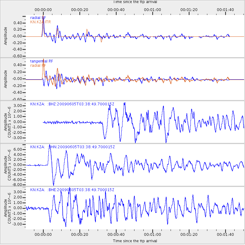
Earthquake location: Hokkaido, Japan Region
Earthquake latitude/longitude: 41.8/143.4
Earthquake time(UTC): 2009/06/05 (156) 03:30:33 GMT
Earthquake Depth: 29 km
Earthquake Magnitude: 6.0 MB, 6.3 MS, 6.4 MW, 6.4 MW
Earthquake Catalog/Contributor: WHDF/NEIC
Network: KN Kyrgyz Seismic Telemetry Network
Station: KZA KN.KZA
Lat/Lon: 42.08 N/75.25 E
Elevation: 3520 m
Distance: 49.4 deg
Az: 294.521 deg
Baz: 65.981 deg
Ray Param: 0.0686482
Estimated Moho Depth: 60.0 km
Estimated Crust Vp/Vs: 1.76
Assumed Crust Vp: 6.306 km/s
Estimated Crust Vs: 3.578 km/s
Estimated Crust Poisson's Ratio: 0.26
Radial Match: 94.831 %
Radial Bump: 400
Transverse Match: 91.74133 %
Transverse Bump: 400
SOD ConfigId: 2648
Insert Time: 2010-03-08 20:25:05.246 +0000
GWidth: 2.5
Max Bumps: 400
Tol: 0.001

Signal To Noise

ChannelStoNSTALTA
KN:KZA: :BHN:20090605T03:38:49.700015Z38.100453.4588772E-69.078312E-8
KN:KZA: :BHE:20090605T03:38:49.700015Z7.2385229.311833E-71.2864274E-7
KN:KZA: :BHZ:20090605T03:38:49.700015Z13.7742851.4322793E-61.0398212E-7
Arrivals
Ps7.7 SECOND
PpPs25 SECOND
PsPs/PpSs33 SECOND