KZA KN.KZA - Earthquake Result Viewer
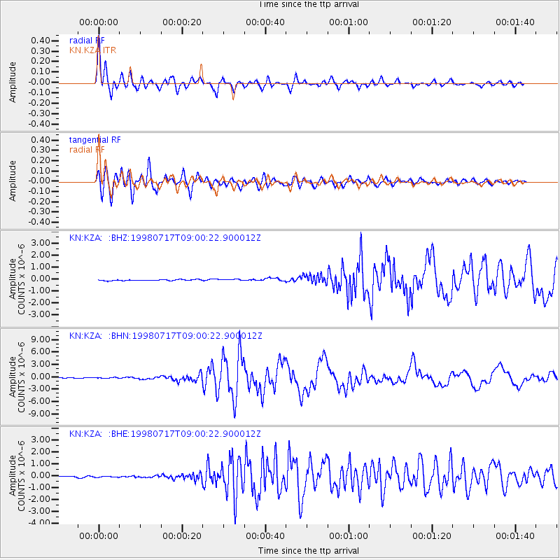
Earthquake location: Near N Coast Of New Guinea, P.N.G.
Earthquake latitude/longitude: -3.0/141.9
Earthquake time(UTC): 1998/07/17 (198) 08:49:13 GMT
Earthquake Depth: 10 km
Earthquake Magnitude: 5.8 MB, 7.1 MS, 7.1 UNKNOWN, 6.4 ME
Earthquake Catalog/Contributor: WHDF/NEIC
Network: KN Kyrgyz Seismic Telemetry Network
Station: KZA KN.KZA
Lat/Lon: 42.08 N/75.25 E
Elevation: 3520 m
Distance: 74.9 deg
Az: 314.927 deg
Baz: 108.238 deg
Ray Param: 0.052007023
Estimated Moho Depth: 19.25 km
Estimated Crust Vp/Vs: 1.60
Assumed Crust Vp: 6.306 km/s
Estimated Crust Vs: 3.941 km/s
Estimated Crust Poisson's Ratio: 0.18
Radial Match: 95.388275 %
Radial Bump: 400
Transverse Match: 94.84288 %
Transverse Bump: 400
SOD ConfigId: 4480
Insert Time: 2010-03-08 20:25:10.125 +0000
GWidth: 2.5
Max Bumps: 400
Tol: 0.001

Signal To Noise

ChannelStoNSTALTA
KN:KZA: :BHN:19980717T09:00:22.900012Z2.05818068.6153854E-84.185923E-8
KN:KZA: :BHE:19980717T09:00:22.900012Z1.26296175.2551147E-84.160945E-8
KN:KZA: :BHZ:19980717T09:00:22.900012Z1.22140175.332734E-84.366077E-8
Arrivals
Ps1.9 SECOND
PpPs7.7 SECOND
PsPs/PpSs9.6 SECOND