You are here: Home > Network List > TA - USArray Transportable Network (new EarthScope stations) Stations List
> Station R33M Jennings River, BC, CAN > Earthquake Result Viewer
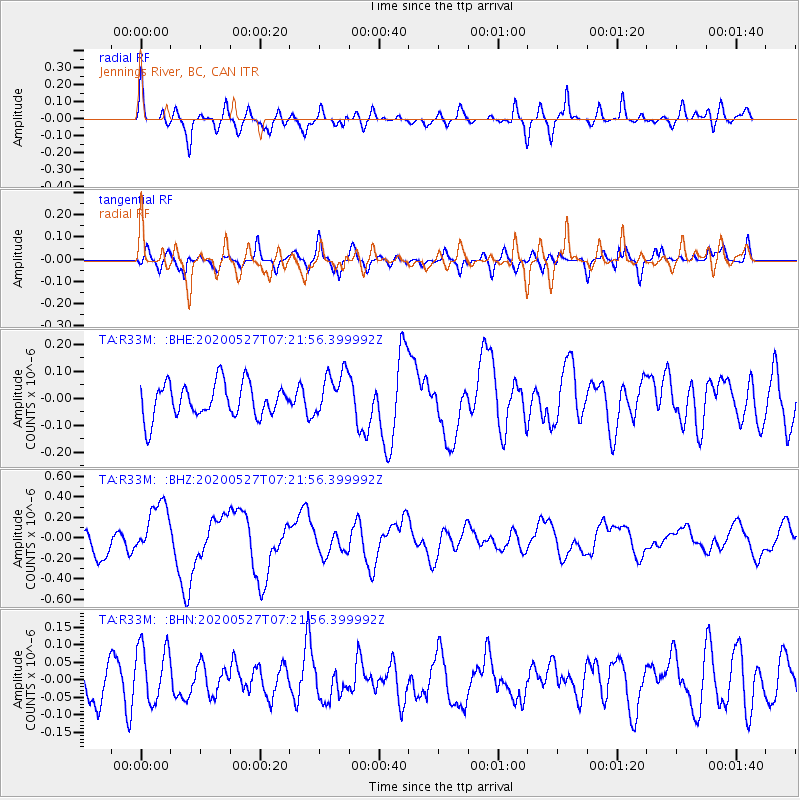
R33M Jennings River, BC, CAN - Earthquake Result Viewer
*The percent match for this event was below the threshold and hence no stack was calculated.
| Earthquake location: |
Vanuatu Islands |
| Earthquake latitude/longitude: |
-18.7/168.1 |
| Earthquake time(UTC): |
2020/05/27 (148) 07:09:18 GMT |
| Earthquake Depth: |
10 km |
| Earthquake Magnitude: |
6.1 Mww |
| Earthquake Catalog/Contributor: |
NEIC PDE/us |
|
| Network: |
TA USArray Transportable Network (new EarthScope stations) |
| Station: |
R33M Jennings River, BC, CAN |
| Lat/Lon: |
59.39 N/130.97 W |
| Elevation: |
1437 m |
|
| Distance: |
92.2 deg |
| Az: |
26.586 deg |
| Baz: |
235.988 deg |
| Ray Param: |
$rayparam |
*The percent match for this event was below the threshold and hence was not used in the summary stack. |
|
| Radial Match: |
65.61136 % |
| Radial Bump: |
400 |
| Transverse Match: |
51.72726 % |
| Transverse Bump: |
400 |
| SOD ConfigId: |
21166931 |
| Insert Time: |
2020-06-10 07:38:50.058 +0000 |
| GWidth: |
2.5 |
| Max Bumps: |
400 |
| Tol: |
0.001 |
|
Signal To Noise
| Channel | StoN | STA | LTA |
| TA:R33M: :BHZ:20200527T07:21:56.399992Z | 2.6425939 | 2.671608E-7 | 1.01097946E-7 |
| TA:R33M: :BHN:20200527T07:21:56.399992Z | 1.4970188 | 8.6805564E-8 | 5.798562E-8 |
| TA:R33M: :BHE:20200527T07:21:56.399992Z | 1.3276463 | 8.340733E-8 | 6.282346E-8 |
| Arrivals |
| Ps | |
| PpPs | |
| PsPs/PpSs | |


