KZA KN.KZA - Earthquake Result Viewer
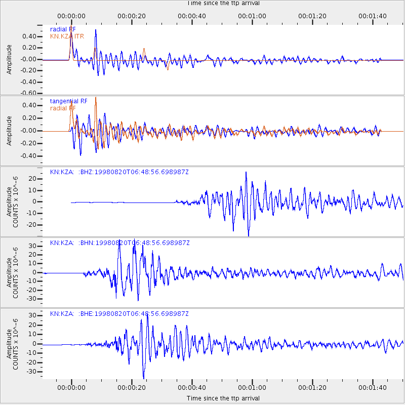
Earthquake location: Bonin Islands, Japan Region
Earthquake latitude/longitude: 28.9/139.3
Earthquake time(UTC): 1998/08/20 (232) 06:40:55 GMT
Earthquake Depth: 441 km
Earthquake Magnitude: 6.1 MB, 7.0 UNKNOWN, 7.0 MW
Earthquake Catalog/Contributor: WHDF/NEIC
Network: KN Kyrgyz Seismic Telemetry Network
Station: KZA KN.KZA
Lat/Lon: 42.08 N/75.25 E
Elevation: 3520 m
Distance: 52.7 deg
Az: 302.625 deg
Baz: 82.594 deg
Ray Param: 0.064804874
Estimated Moho Depth: 51.5 km
Estimated Crust Vp/Vs: 1.96
Assumed Crust Vp: 6.306 km/s
Estimated Crust Vs: 3.217 km/s
Estimated Crust Poisson's Ratio: 0.32
Radial Match: 92.87697 %
Radial Bump: 400
Transverse Match: 84.76517 %
Transverse Bump: 400
SOD ConfigId: 4480
Insert Time: 2010-03-08 20:25:17.714 +0000
GWidth: 2.5
Max Bumps: 400
Tol: 0.001

Signal To Noise

ChannelStoNSTALTA
KN:KZA: :BHN:19980820T06:48:56.698987Z8.3325257.203441E-78.6449674E-8
KN:KZA: :BHE:19980820T06:48:56.698987Z1.91228631.4807259E-77.7432226E-8
KN:KZA: :BHZ:19980820T06:48:56.698987Z5.94262462.854764E-74.803878E-8
Arrivals
Ps8.2 SECOND
PpPs23 SECOND
PsPs/PpSs31 SECOND