
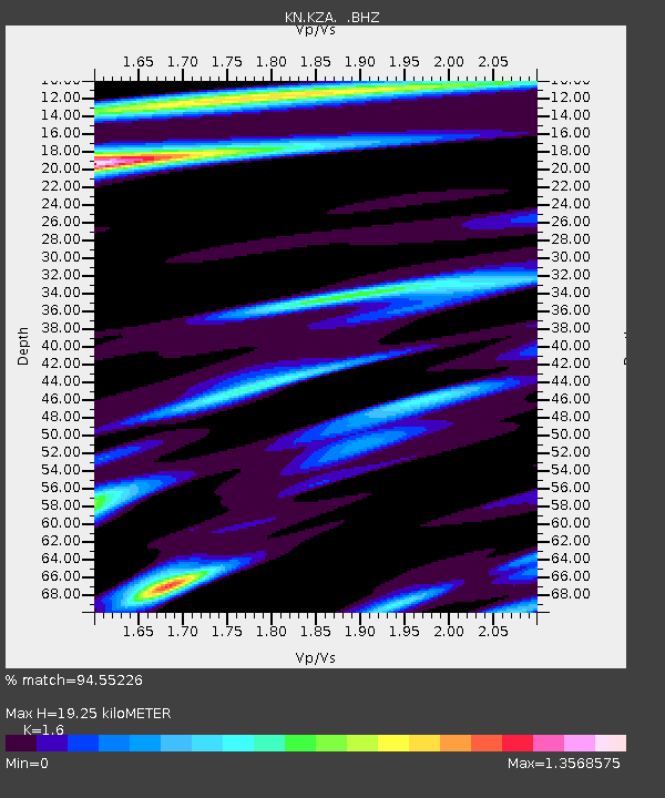
KZA KN.KZA - Earthquake Result Viewer
| ||||||||||||||||||
| ||||||||||||||||||
| ||||||||||||||||||
|
Signal To Noise
| Channel | StoN | STA | LTA |
| KN:KZA: :BHZ:19941008T21:54:09.500024Z | 1.8045156 | 1.7547745E-7 | 9.724352E-8 |
| KN:KZA: :BHN:19941008T21:54:09.500024Z | 2.026556 | 1.2317669E-7 | 6.078129E-8 |
| KN:KZA: :BHE:19941008T21:54:09.500024Z | 1.7019044 | 1.0970094E-7 | 6.445776E-8 |
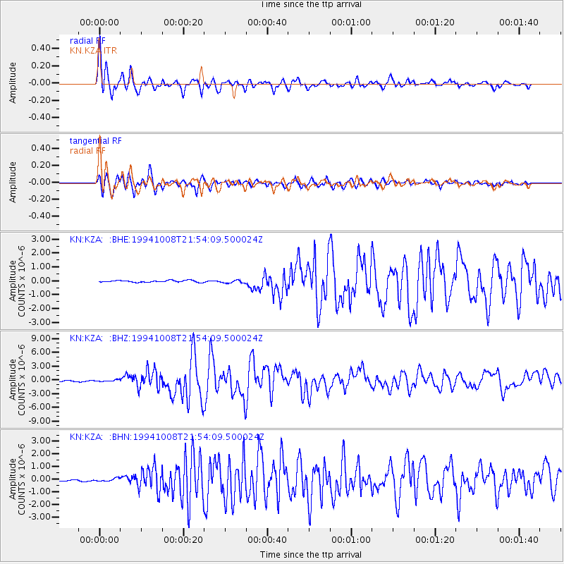
| Arrivals | |
| Ps | 1.9 SECOND |
| PpPs | 7.6 SECOND |
| PsPs/PpSs | 9.5 SECOND |

