KZA KN.KZA - Earthquake Result Viewer
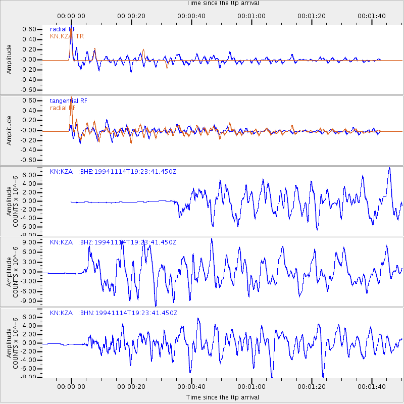
Earthquake location: Mindoro, Philippines
Earthquake latitude/longitude: 13.5/121.1
Earthquake time(UTC): 1994/11/14 (318) 19:15:30 GMT
Earthquake Depth: 33 km
Earthquake Magnitude: 6.1 MB, 7.1 MS, 7.1 UNKNOWN, 7.1 MW
Earthquake Catalog/Contributor: WHDF/NEIC
Network: KN Kyrgyz Seismic Telemetry Network
Station: KZA KN.KZA
Lat/Lon: 42.08 N/75.25 E
Elevation: 3520 m
Distance: 48.7 deg
Az: 314.715 deg
Baz: 111.818 deg
Ray Param: 0.069105014
Estimated Moho Depth: 19.75 km
Estimated Crust Vp/Vs: 1.60
Assumed Crust Vp: 6.306 km/s
Estimated Crust Vs: 3.941 km/s
Estimated Crust Poisson's Ratio: 0.18
Radial Match: 94.64651 %
Radial Bump: 388
Transverse Match: 89.47963 %
Transverse Bump: 400
SOD ConfigId: 4480
Insert Time: 2010-03-08 20:25:50.842 +0000
GWidth: 2.5
Max Bumps: 400
Tol: 0.001

Signal To Noise

ChannelStoNSTALTA
KN:KZA: :BHZ:19941114T19:23:41.450Z4.57801153.6358185E-77.9419166E-8
KN:KZA: :BHN:19941114T19:23:41.450Z1.04334012.3718263E-72.2733012E-7
KN:KZA: :BHE:19941114T19:23:41.450Z4.35564763.032968E-76.9632996E-8
Arrivals
Ps2.0 SECOND
PpPs7.6 SECOND
PsPs/PpSs9.6 SECOND