KZA KN.KZA - Earthquake Result Viewer
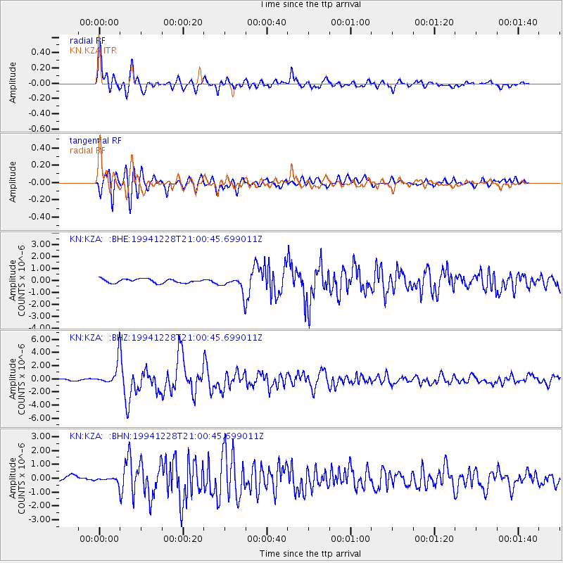
Earthquake location: Near East Coast Of Honshu, Japan
Earthquake latitude/longitude: 40.0/142.7
Earthquake time(UTC): 1994/12/28 (362) 20:52:28 GMT
Earthquake Depth: 48 km
Earthquake Magnitude: 5.7 MB, 5.8 MS, 5.4 UNKNOWN, 6.2 MW
Earthquake Catalog/Contributor: WHDF/NEIC
Network: KN Kyrgyz Seismic Telemetry Network
Station: KZA KN.KZA
Lat/Lon: 42.08 N/75.25 E
Elevation: 3520 m
Distance: 49.7 deg
Az: 295.634 deg
Baz: 68.405 deg
Ray Param: 0.068405874
Estimated Moho Depth: 61.25 km
Estimated Crust Vp/Vs: 1.77
Assumed Crust Vp: 6.306 km/s
Estimated Crust Vs: 3.558 km/s
Estimated Crust Poisson's Ratio: 0.27
Radial Match: 93.537155 %
Radial Bump: 400
Transverse Match: 85.80917 %
Transverse Bump: 400
SOD ConfigId: 4480
Insert Time: 2010-03-08 20:25:59.850 +0000
GWidth: 2.5
Max Bumps: 400
Tol: 0.001

Signal To Noise

ChannelStoNSTALTA
KN:KZA: :BHZ:19941228T21:00:45.699011Z11.8345761.8821586E-61.5903896E-7
KN:KZA: :BHN:19941228T21:00:45.699011Z0.7691861.7906412E-72.3279689E-7
KN:KZA: :BHE:19941228T21:00:45.699011Z4.3137067.1520014E-71.6579715E-7
Arrivals
Ps7.9 SECOND
PpPs25 SECOND
PsPs/PpSs33 SECOND