
KZA KN.KZA - Earthquake Result Viewer
| ||||||||||||||||||
| ||||||||||||||||||
| ||||||||||||||||||
|
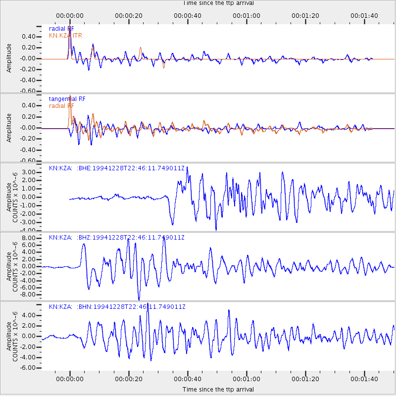
Signal To Noise
| Channel | StoN | STA | LTA |
| KN:KZA: :BHZ:19941228T22:46:11.749011Z | 18.443874 | 2.50416E-6 | 1.357719E-7 |
| KN:KZA: :BHN:19941228T22:46:11.749011Z | 2.2941864 | 6.7753626E-7 | 2.953275E-7 |
| KN:KZA: :BHE:19941228T22:46:11.749011Z | 7.715115 | 1.0490138E-6 | 1.3596865E-7 |
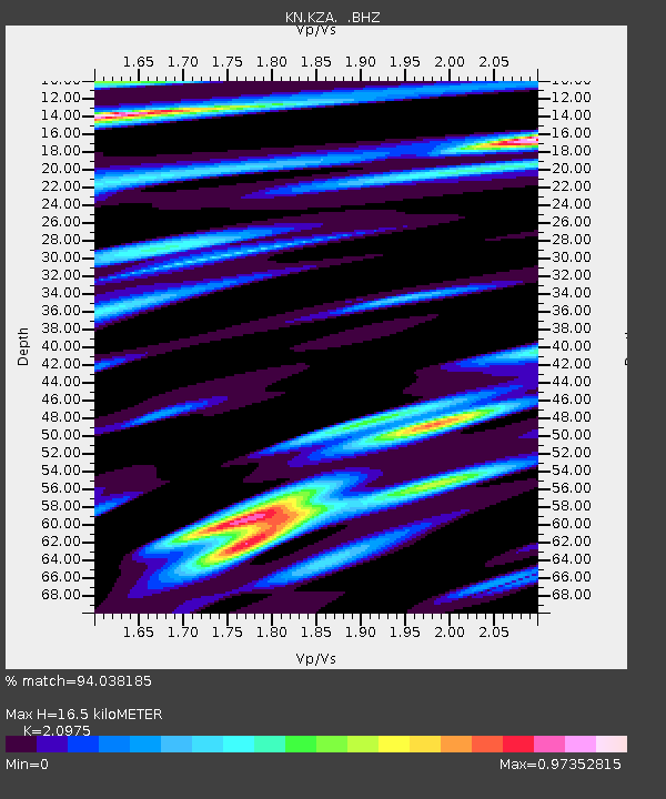
| Arrivals | |
| Ps | 3.0 SECOND |
| PpPs | 7.7 SECOND |
| PsPs/PpSs | 11 SECOND |

