KZA KN.KZA - Earthquake Result Viewer
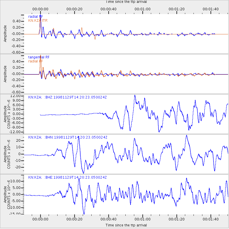
Earthquake location: Ceram Sea
Earthquake latitude/longitude: -2.1/124.9
Earthquake time(UTC): 1998/11/29 (333) 14:10:31 GMT
Earthquake Depth: 33 km
Earthquake Magnitude: 6.5 MB, 7.7 MS, 8.1 UNKNOWN, 7.8 MW
Earthquake Catalog/Contributor: WHDF/NEIC
Network: KN Kyrgyz Seismic Telemetry Network
Station: KZA KN.KZA
Lat/Lon: 42.08 N/75.25 E
Elevation: 3520 m
Distance: 62.8 deg
Az: 320.351 deg
Baz: 121.068 deg
Ray Param: 0.059966147
Estimated Moho Depth: 19.25 km
Estimated Crust Vp/Vs: 1.60
Assumed Crust Vp: 6.306 km/s
Estimated Crust Vs: 3.941 km/s
Estimated Crust Poisson's Ratio: 0.18
Radial Match: 94.22118 %
Radial Bump: 400
Transverse Match: 87.43769 %
Transverse Bump: 400
SOD ConfigId: 4480
Insert Time: 2010-03-08 20:26:15.056 +0000
GWidth: 2.5
Max Bumps: 400
Tol: 0.001

Signal To Noise

ChannelStoNSTALTA
KN:KZA: :BHN:19981129T14:20:23.050024Z3.2415321.0595164E-63.2685668E-7
KN:KZA: :BHE:19981129T14:20:23.050024Z3.40697657.6591016E-72.2480641E-7
KN:KZA: :BHZ:19981129T14:20:23.050024Z4.0315148.966946E-72.2242129E-7
Arrivals
Ps1.9 SECOND
PpPs7.6 SECOND
PsPs/PpSs9.5 SECOND